You are here: Home > Network List > US - United States National Seismic Network Stations List
> Station DGMT Dagmar, Montana, USA > Earthquake Result Viewer
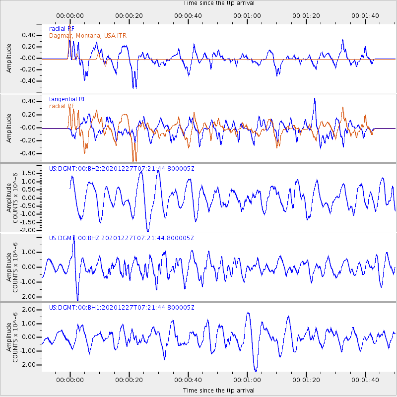
DGMT Dagmar, Montana, USA - Earthquake Result Viewer
*The percent match for this event was below the threshold and hence no stack was calculated.
| Earthquake location: |
Near Coast Of Peru |
| Earthquake latitude/longitude: |
-16.0/-74.3 |
| Earthquake time(UTC): |
2020/12/27 (362) 07:11:10 GMT |
| Earthquake Depth: |
34 km |
| Earthquake Magnitude: |
5.7 Mww |
| Earthquake Catalog/Contributor: |
NEIC PDE/us |
|
| Network: |
US United States National Seismic Network |
| Station: |
DGMT Dagmar, Montana, USA |
| Lat/Lon: |
48.47 N/104.20 W |
| Elevation: |
0.0 m |
|
| Distance: |
69.5 deg |
| Az: |
339.289 deg |
| Baz: |
149.27 deg |
| Ray Param: |
$rayparam |
*The percent match for this event was below the threshold and hence was not used in the summary stack. |
|
| Radial Match: |
57.815536 % |
| Radial Bump: |
400 |
| Transverse Match: |
45.965183 % |
| Transverse Bump: |
400 |
| SOD ConfigId: |
23341671 |
| Insert Time: |
2021-01-10 08:32:12.358 +0000 |
| GWidth: |
2.5 |
| Max Bumps: |
400 |
| Tol: |
0.001 |
|
Signal To Noise
| Channel | StoN | STA | LTA |
| US:DGMT:00:BHZ:20201227T07:21:44.800005Z | 3.4839644 | 1.0823065E-6 | 3.1065375E-7 |
| US:DGMT:00:BH1:20201227T07:21:44.800005Z | 0.89577955 | 6.1677304E-7 | 6.8853217E-7 |
| US:DGMT:00:BH2:20201227T07:21:44.800005Z | 1.1522565 | 9.2678914E-7 | 8.043254E-7 |
| Arrivals |
| Ps | |
| PpPs | |
| PsPs/PpSs | |


