You are here: Home > Network List > US - United States National Seismic Network Stations List
> Station EGMT Eagleton, Montana, USA > Earthquake Result Viewer
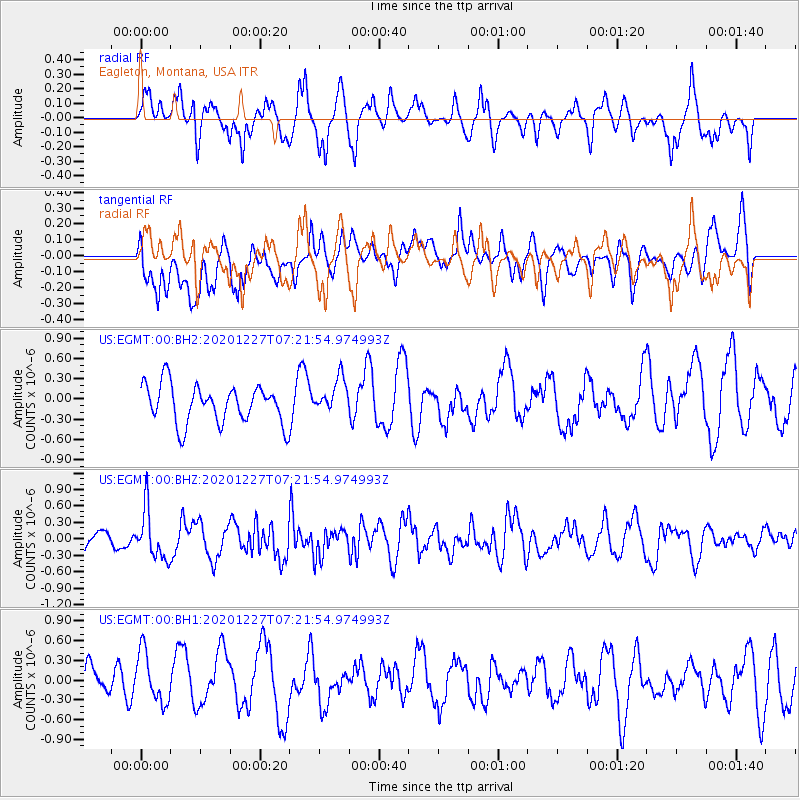
EGMT Eagleton, Montana, USA - Earthquake Result Viewer
*The percent match for this event was below the threshold and hence no stack was calculated.
| Earthquake location: |
Near Coast Of Peru |
| Earthquake latitude/longitude: |
-16.0/-74.3 |
| Earthquake time(UTC): |
2020/12/27 (362) 07:11:10 GMT |
| Earthquake Depth: |
34 km |
| Earthquake Magnitude: |
5.7 Mww |
| Earthquake Catalog/Contributor: |
NEIC PDE/us |
|
| Network: |
US United States National Seismic Network |
| Station: |
EGMT Eagleton, Montana, USA |
| Lat/Lon: |
48.02 N/109.75 W |
| Elevation: |
1055 m |
|
| Distance: |
71.2 deg |
| Az: |
335.734 deg |
| Baz: |
143.937 deg |
| Ray Param: |
$rayparam |
*The percent match for this event was below the threshold and hence was not used in the summary stack. |
|
| Radial Match: |
63.358402 % |
| Radial Bump: |
382 |
| Transverse Match: |
57.079212 % |
| Transverse Bump: |
400 |
| SOD ConfigId: |
23341671 |
| Insert Time: |
2021-01-10 08:32:15.243 +0000 |
| GWidth: |
2.5 |
| Max Bumps: |
400 |
| Tol: |
0.001 |
|
Signal To Noise
| Channel | StoN | STA | LTA |
| US:EGMT:00:BHZ:20201227T07:21:54.974993Z | 2.6147165 | 4.5287965E-7 | 1.7320411E-7 |
| US:EGMT:00:BH1:20201227T07:21:54.974993Z | 0.93700165 | 3.8504064E-7 | 4.1092844E-7 |
| US:EGMT:00:BH2:20201227T07:21:54.974993Z | 0.9287889 | 2.6420085E-7 | 2.844574E-7 |
| Arrivals |
| Ps | |
| PpPs | |
| PsPs/PpSs | |


