You are here: Home > Network List > UU - University of Utah Regional Network Stations List
> Station KNB Kanab, UT, USA > Earthquake Result Viewer
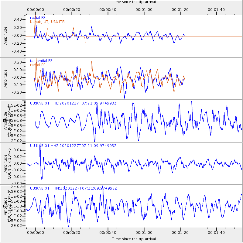
KNB Kanab, UT, USA - Earthquake Result Viewer
*The percent match for this event was below the threshold and hence no stack was calculated.
| Earthquake location: |
Near Coast Of Peru |
| Earthquake latitude/longitude: |
-16.0/-74.3 |
| Earthquake time(UTC): |
2020/12/27 (362) 07:11:10 GMT |
| Earthquake Depth: |
34 km |
| Earthquake Magnitude: |
5.7 Mww |
| Earthquake Catalog/Contributor: |
NEIC PDE/us |
|
| Network: |
UU University of Utah Regional Network |
| Station: |
KNB Kanab, UT, USA |
| Lat/Lon: |
37.02 N/112.82 W |
| Elevation: |
1715 m |
|
| Distance: |
64.0 deg |
| Az: |
326.359 deg |
| Baz: |
138.275 deg |
| Ray Param: |
$rayparam |
*The percent match for this event was below the threshold and hence was not used in the summary stack. |
|
| Radial Match: |
40.21025 % |
| Radial Bump: |
400 |
| Transverse Match: |
42.455345 % |
| Transverse Bump: |
400 |
| SOD ConfigId: |
23341671 |
| Insert Time: |
2021-01-10 08:33:11.603 +0000 |
| GWidth: |
2.5 |
| Max Bumps: |
400 |
| Tol: |
0.001 |
|
Signal To Noise
| Channel | StoN | STA | LTA |
| UU:KNB:01:HHZ:20201227T07:21:09.974993Z | 8.099 | 2.4389108E-8 | 3.011373E-9 |
| UU:KNB:01:HHN:20201227T07:21:09.974993Z | 1.9608856 | 7.438902E-9 | 3.793644E-9 |
| UU:KNB:01:HHE:20201227T07:21:09.974993Z | 2.2615297 | 9.981087E-9 | 4.4134225E-9 |
| Arrivals |
| Ps | |
| PpPs | |
| PsPs/PpSs | |


