You are here: Home > Network List > WY - Yellowstone Wyoming Seismic Network Stations List
> Station YHH Holmes Hill, YNP, WY, USA > Earthquake Result Viewer
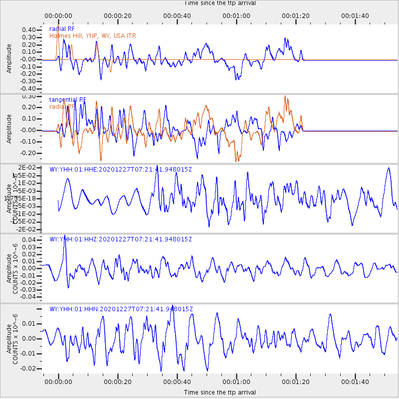
YHH Holmes Hill, YNP, WY, USA - Earthquake Result Viewer
*The percent match for this event was below the threshold and hence no stack was calculated.
| Earthquake location: |
Near Coast Of Peru |
| Earthquake latitude/longitude: |
-16.0/-74.3 |
| Earthquake time(UTC): |
2020/12/27 (362) 07:11:10 GMT |
| Earthquake Depth: |
34 km |
| Earthquake Magnitude: |
5.7 Mww |
| Earthquake Catalog/Contributor: |
NEIC PDE/us |
|
| Network: |
WY Yellowstone Wyoming Seismic Network |
| Station: |
YHH Holmes Hill, YNP, WY, USA |
| Lat/Lon: |
44.79 N/110.85 W |
| Elevation: |
2717 m |
|
| Distance: |
69.0 deg |
| Az: |
333.022 deg |
| Baz: |
142.222 deg |
| Ray Param: |
$rayparam |
*The percent match for this event was below the threshold and hence was not used in the summary stack. |
|
| Radial Match: |
45.00262 % |
| Radial Bump: |
400 |
| Transverse Match: |
59.85592 % |
| Transverse Bump: |
400 |
| SOD ConfigId: |
23341671 |
| Insert Time: |
2021-01-10 08:34:45.186 +0000 |
| GWidth: |
2.5 |
| Max Bumps: |
400 |
| Tol: |
0.001 |
|
Signal To Noise
| Channel | StoN | STA | LTA |
| WY:YHH:01:HHZ:20201227T07:21:41.948015Z | 3.6477702 | 1.9181597E-8 | 5.258445E-9 |
| WY:YHH:01:HHN:20201227T07:21:41.948015Z | 1.5723715 | 6.684046E-9 | 4.2509334E-9 |
| WY:YHH:01:HHE:20201227T07:21:41.948015Z | 1.9080031 | 9.566853E-9 | 5.0140656E-9 |
| Arrivals |
| Ps | |
| PpPs | |
| PsPs/PpSs | |


