You are here: Home > Network List > G - GEOSCOPE Stations List
> Station CLF Chambon la Foret observatory, France > Earthquake Result Viewer
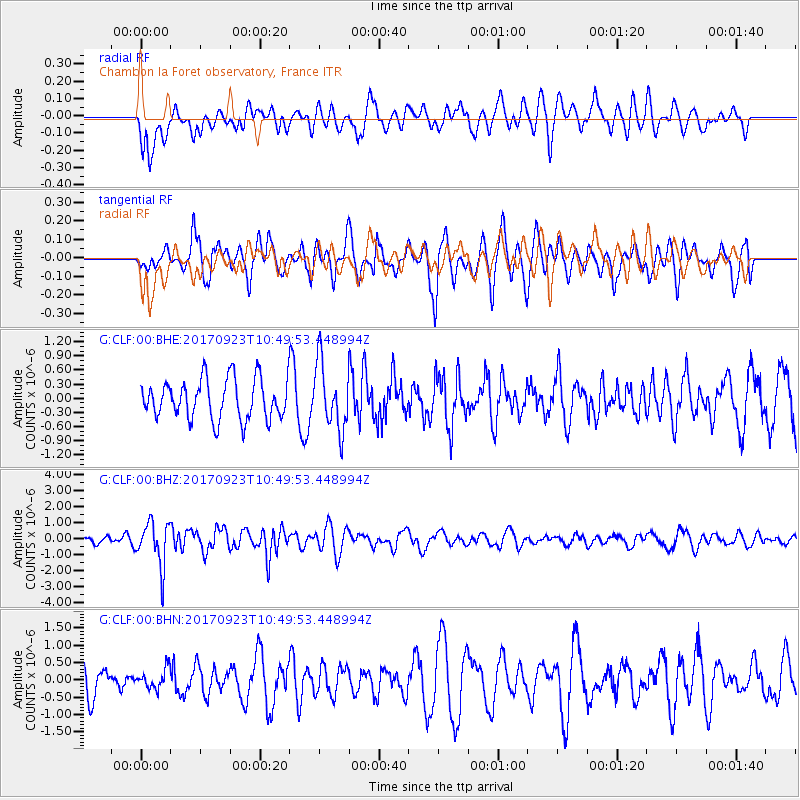
CLF Chambon la Foret observatory, France - Earthquake Result Viewer
*The percent match for this event was below the threshold and hence no stack was calculated.
| Earthquake location: |
Near Coast Of Oaxaca, Mexico |
| Earthquake latitude/longitude: |
15.7/-94.2 |
| Earthquake time(UTC): |
2017/09/23 (266) 10:38:08 GMT |
| Earthquake Depth: |
74 km |
| Earthquake Magnitude: |
5.8 Mww |
| Earthquake Catalog/Contributor: |
NEIC PDE/us |
|
| Network: |
G GEOSCOPE |
| Station: |
CLF Chambon la Foret observatory, France |
| Lat/Lon: |
48.03 N/2.26 E |
| Elevation: |
145 m |
|
| Distance: |
82.7 deg |
| Az: |
42.261 deg |
| Baz: |
285.217 deg |
| Ray Param: |
$rayparam |
*The percent match for this event was below the threshold and hence was not used in the summary stack. |
|
| Radial Match: |
47.820488 % |
| Radial Bump: |
400 |
| Transverse Match: |
63.502934 % |
| Transverse Bump: |
400 |
| SOD ConfigId: |
2364251 |
| Insert Time: |
2017-10-09 20:40:35.860 +0000 |
| GWidth: |
2.5 |
| Max Bumps: |
400 |
| Tol: |
0.001 |
|
Signal To Noise
| Channel | StoN | STA | LTA |
| G:CLF:00:BHZ:20170923T10:49:53.448994Z | 4.6143394 | 1.3584803E-6 | 2.944041E-7 |
| G:CLF:00:BHN:20170923T10:49:53.448994Z | 0.59535587 | 2.804329E-7 | 4.7103404E-7 |
| G:CLF:00:BHE:20170923T10:49:53.448994Z | 1.675201 | 7.0363603E-7 | 4.2003077E-7 |
| Arrivals |
| Ps | |
| PpPs | |
| PsPs/PpSs | |


