You are here: Home > Network List > US - United States National Seismic Network Stations List
> Station EGMT Eagleton, Montana, USA > Earthquake Result Viewer
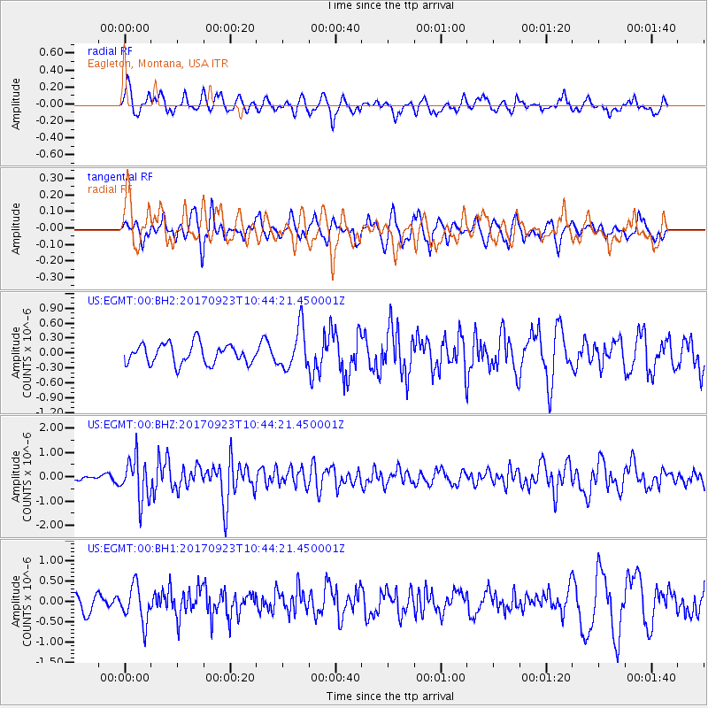
EGMT Eagleton, Montana, USA - Earthquake Result Viewer
*The percent match for this event was below the threshold and hence no stack was calculated.
| Earthquake location: |
Near Coast Of Oaxaca, Mexico |
| Earthquake latitude/longitude: |
15.7/-94.2 |
| Earthquake time(UTC): |
2017/09/23 (266) 10:38:08 GMT |
| Earthquake Depth: |
74 km |
| Earthquake Magnitude: |
5.8 Mww |
| Earthquake Catalog/Contributor: |
NEIC PDE/us |
|
| Network: |
US United States National Seismic Network |
| Station: |
EGMT Eagleton, Montana, USA |
| Lat/Lon: |
48.02 N/109.75 W |
| Elevation: |
1055 m |
|
| Distance: |
34.7 deg |
| Az: |
341.524 deg |
| Baz: |
152.955 deg |
| Ray Param: |
$rayparam |
*The percent match for this event was below the threshold and hence was not used in the summary stack. |
|
| Radial Match: |
68.2002 % |
| Radial Bump: |
400 |
| Transverse Match: |
55.797928 % |
| Transverse Bump: |
400 |
| SOD ConfigId: |
2364251 |
| Insert Time: |
2017-10-09 20:42:40.075 +0000 |
| GWidth: |
2.5 |
| Max Bumps: |
400 |
| Tol: |
0.001 |
|
Signal To Noise
| Channel | StoN | STA | LTA |
| US:EGMT:00:BHZ:20170923T10:44:21.450001Z | 15.81739 | 8.698957E-7 | 5.499616E-8 |
| US:EGMT:00:BH1:20170923T10:44:21.450001Z | 2.4097545 | 4.5550834E-7 | 1.8902686E-7 |
| US:EGMT:00:BH2:20170923T10:44:21.450001Z | 2.1057062 | 4.16655E-7 | 1.9786948E-7 |
| Arrivals |
| Ps | |
| PpPs | |
| PsPs/PpSs | |


