You are here: Home > Network List > US - United States National Seismic Network Stations List
> Station LAO LASA Array, Montana, USA > Earthquake Result Viewer
LAO LASA Array, Montana, USA - Earthquake Result Viewer
*The percent match for this event was below the threshold and hence no stack was calculated.
| Earthquake location: |
Near Coast Of Oaxaca, Mexico |
| Earthquake latitude/longitude: |
15.7/-94.2 |
| Earthquake time(UTC): |
2017/09/23 (266) 10:38:08 GMT |
| Earthquake Depth: |
74 km |
| Earthquake Magnitude: |
5.8 Mww |
| Earthquake Catalog/Contributor: |
NEIC PDE/us |
|
| Network: |
US United States National Seismic Network |
| Station: |
LAO LASA Array, Montana, USA |
| Lat/Lon: |
46.69 N/106.22 W |
| Elevation: |
902 m |
|
| Distance: |
32.5 deg |
| Az: |
344.47 deg |
| Baz: |
157.999 deg |
| Ray Param: |
$rayparam |
*The percent match for this event was below the threshold and hence was not used in the summary stack. |
|
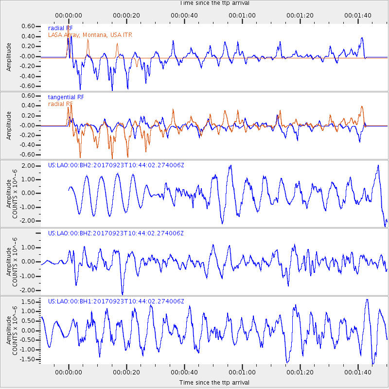
| Radial Match: |
68.399025 % |
| Radial Bump: |
360 |
| Transverse Match: |
45.453266 % |
| Transverse Bump: |
270 |
| SOD ConfigId: |
2364251 |
| Insert Time: |
2017-10-09 20:42:46.714 +0000 |
| GWidth: |
2.5 |
| Max Bumps: |
400 |
| Tol: |
0.001 |
|
Signal To Noise
| Channel | StoN | STA | LTA |
| US:LAO:00:BHZ:20170923T10:44:02.274006Z | 1.9366094 | 6.667597E-7 | 3.442923E-7 |
| US:LAO:00:BH1:20170923T10:44:02.274006Z | 0.5526745 | 4.12882E-7 | 7.4706185E-7 |
| US:LAO:00:BH2:20170923T10:44:02.274006Z | 0.3381198 | 3.2243466E-7 | 9.5361065E-7 |
| Arrivals |
| Ps | |
| PpPs | |
| PsPs/PpSs | |


