AKSU XW.AKSU - Earthquake Result Viewer
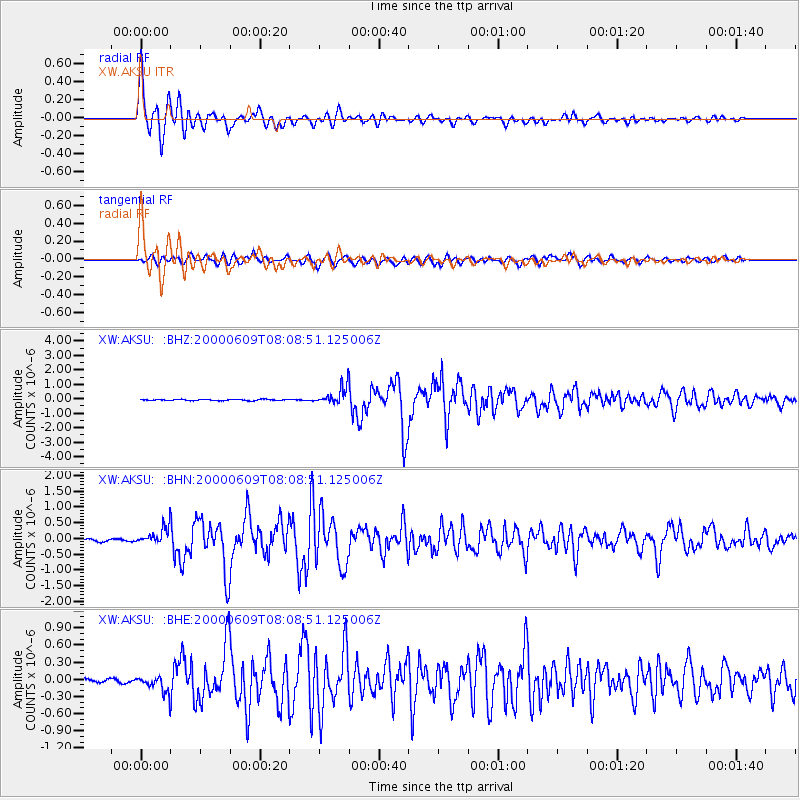
Earthquake location: Southern Sumatra, Indonesia
Earthquake latitude/longitude: -5.5/102.7
Earthquake time(UTC): 2000/06/09 (161) 08:00:24 GMT
Earthquake Depth: 33 km
Earthquake Magnitude: 5.8 MB, 5.8 MS, 6.0 MW, 6.0 MW
Earthquake Catalog/Contributor: WHDF/NEIC
Network: XW Tien Shan Continental Dynamics
Station: AKSU XW.AKSU
Lat/Lon: 41.14 N/80.11 E
Elevation: 1109 m
Distance: 50.9 deg
Az: 338.055 deg
Baz: 150.492 deg
Ray Param: 0.06771497
Estimated Moho Depth: 13.5 km
Estimated Crust Vp/Vs: 2.08
Assumed Crust Vp: 6.129 km/s
Estimated Crust Vs: 2.947 km/s
Estimated Crust Poisson's Ratio: 0.35
Radial Match: 96.23367 %
Radial Bump: 400
Transverse Match: 88.52296 %
Transverse Bump: 400
SOD ConfigId: 20082
Insert Time: 2010-02-26 15:14:04.553 +0000
GWidth: 2.5
Max Bumps: 400
Tol: 0.001

Signal To Noise

ChannelStoNSTALTA
XW:AKSU: :BHN:20000609T08:08:51.125006Z7.6513272.704752E-73.5350105E-8
XW:AKSU: :BHE:20000609T08:08:51.125006Z5.86588241.3971976E-72.3819053E-8
XW:AKSU: :BHZ:20000609T08:08:51.125006Z14.6309056.14393E-74.1992823E-8
Arrivals
Ps2.5 SECOND
PpPs6.5 SECOND
PsPs/PpSs9.0 SECOND