You are here: Home > Network List > GS - US Geological Survey Networks Stations List
> Station DEC09 Kile Street Surface Site > Earthquake Result Viewer
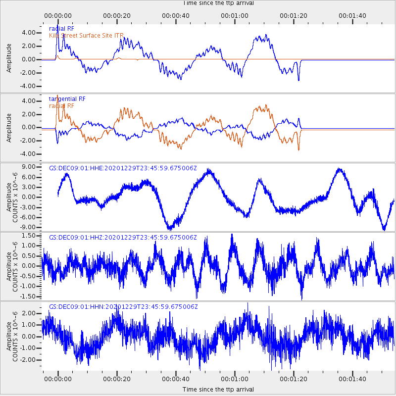
DEC09 Kile Street Surface Site - Earthquake Result Viewer
*The percent match for this event was below the threshold and hence no stack was calculated.
| Earthquake location: |
Central Mid-Atlantic Ridge |
| Earthquake latitude/longitude: |
-0.8/-21.1 |
| Earthquake time(UTC): |
2020/12/29 (364) 23:34:57 GMT |
| Earthquake Depth: |
10 km |
| Earthquake Magnitude: |
5.9 mww |
| Earthquake Catalog/Contributor: |
NEIC PDE/us |
|
| Network: |
GS US Geological Survey Networks |
| Station: |
DEC09 Kile Street Surface Site |
| Lat/Lon: |
39.87 N/88.92 W |
| Elevation: |
207 m |
|
| Distance: |
73.6 deg |
| Az: |
312.035 deg |
| Baz: |
105.192 deg |
| Ray Param: |
$rayparam |
*The percent match for this event was below the threshold and hence was not used in the summary stack. |
|
| Radial Match: |
71.49522 % |
| Radial Bump: |
400 |
| Transverse Match: |
68.87001 % |
| Transverse Bump: |
400 |
| SOD ConfigId: |
23341671 |
| Insert Time: |
2021-01-13 00:41:56.694 +0000 |
| GWidth: |
2.5 |
| Max Bumps: |
400 |
| Tol: |
0.001 |
|
Signal To Noise
| Channel | StoN | STA | LTA |
| GS:DEC09:01:HHZ:20201229T23:45:59.675006Z | 0.9508552 | 3.8412938E-7 | 4.0398302E-7 |
| GS:DEC09:01:HHN:20201229T23:45:59.675006Z | 0.85544354 | 6.051546E-7 | 7.074161E-7 |
| GS:DEC09:01:HHE:20201229T23:45:59.675006Z | 1.0628583 | 2.7688832E-6 | 2.605129E-6 |
| Arrivals |
| Ps | |
| PpPs | |
| PsPs/PpSs | |


