You are here: Home > Network List > US - United States National Seismic Network Stations List
> Station MSO Missoula, Montana, USA > Earthquake Result Viewer
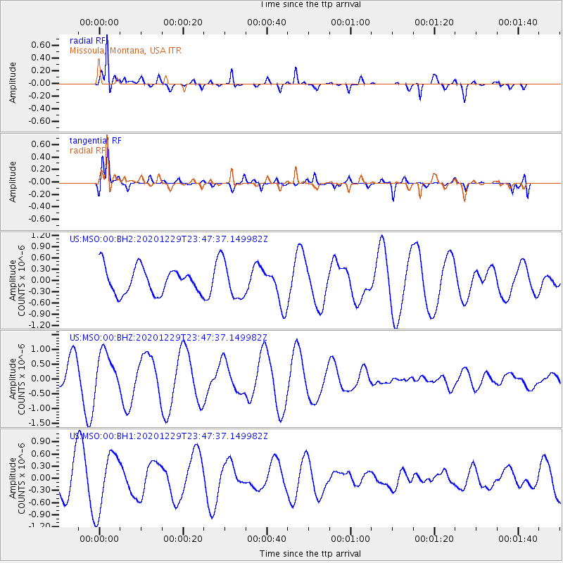
MSO Missoula, Montana, USA - Earthquake Result Viewer
*The percent match for this event was below the threshold and hence no stack was calculated.
| Earthquake location: |
Central Mid-Atlantic Ridge |
| Earthquake latitude/longitude: |
-0.8/-21.1 |
| Earthquake time(UTC): |
2020/12/29 (364) 23:34:57 GMT |
| Earthquake Depth: |
10 km |
| Earthquake Magnitude: |
5.9 mww |
| Earthquake Catalog/Contributor: |
NEIC PDE/us |
|
| Network: |
US United States National Seismic Network |
| Station: |
MSO Missoula, Montana, USA |
| Lat/Lon: |
46.83 N/113.94 W |
| Elevation: |
1264 m |
|
| Distance: |
92.5 deg |
| Az: |
316.652 deg |
| Baz: |
88.47 deg |
| Ray Param: |
$rayparam |
*The percent match for this event was below the threshold and hence was not used in the summary stack. |
|
| Radial Match: |
90.45133 % |
| Radial Bump: |
360 |
| Transverse Match: |
83.068855 % |
| Transverse Bump: |
400 |
| SOD ConfigId: |
23341671 |
| Insert Time: |
2021-01-13 00:50:28.184 +0000 |
| GWidth: |
2.5 |
| Max Bumps: |
400 |
| Tol: |
0.001 |
|
Signal To Noise
| Channel | StoN | STA | LTA |
| US:MSO:00:BHZ:20201229T23:47:37.149982Z | 1.3603319 | 6.6943335E-7 | 4.9211036E-7 |
| US:MSO:00:BH1:20201229T23:47:37.149982Z | 1.6465878 | 7.00179E-7 | 4.2523027E-7 |
| US:MSO:00:BH2:20201229T23:47:37.149982Z | 1.4230027 | 4.822671E-7 | 3.389081E-7 |
| Arrivals |
| Ps | |
| PpPs | |
| PsPs/PpSs | |


