You are here: Home > Network List > CI - Caltech Regional Seismic Network Stations List
> Station MPM Manuel Prospect Mine, California, USA > Earthquake Result Viewer
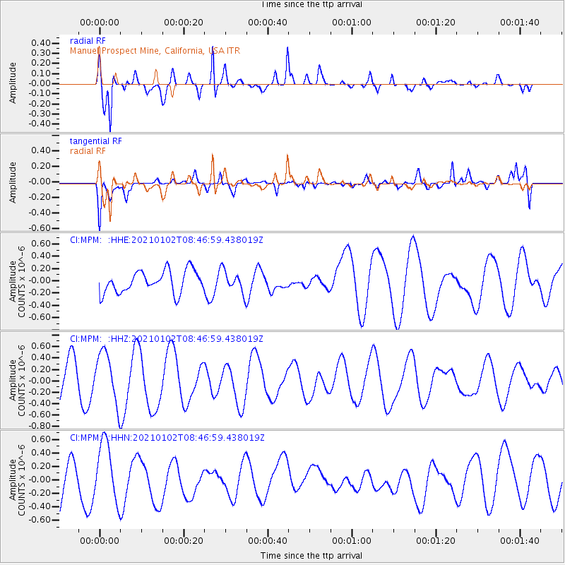
MPM Manuel Prospect Mine, California, USA - Earthquake Result Viewer
*The percent match for this event was below the threshold and hence no stack was calculated.
| Earthquake location: |
New Ireland Region, P.N.G. |
| Earthquake latitude/longitude: |
-5.8/153.1 |
| Earthquake time(UTC): |
2021/01/02 (002) 08:34:18 GMT |
| Earthquake Depth: |
10 km |
| Earthquake Magnitude: |
5.2 Mww |
| Earthquake Catalog/Contributor: |
NEIC PDE/us |
|
| Network: |
CI Caltech Regional Seismic Network |
| Station: |
MPM Manuel Prospect Mine, California, USA |
| Lat/Lon: |
36.06 N/117.49 W |
| Elevation: |
185 m |
|
| Distance: |
92.9 deg |
| Az: |
54.222 deg |
| Baz: |
264.967 deg |
| Ray Param: |
$rayparam |
*The percent match for this event was below the threshold and hence was not used in the summary stack. |
|
| Radial Match: |
72.10034 % |
| Radial Bump: |
400 |
| Transverse Match: |
39.202305 % |
| Transverse Bump: |
400 |
| SOD ConfigId: |
23341671 |
| Insert Time: |
2021-01-16 09:39:44.502 +0000 |
| GWidth: |
2.5 |
| Max Bumps: |
400 |
| Tol: |
0.001 |
|
Signal To Noise
| Channel | StoN | STA | LTA |
| CI:MPM: :HHZ:20210102T08:46:59.438019Z | 1.9254466 | 4.6308094E-7 | 2.4050573E-7 |
| CI:MPM: :HHN:20210102T08:46:59.438019Z | 1.7681153 | 4.68374E-7 | 2.6490017E-7 |
| CI:MPM: :HHE:20210102T08:46:59.438019Z | 0.98977923 | 1.7795016E-7 | 1.7978772E-7 |
| Arrivals |
| Ps | |
| PpPs | |
| PsPs/PpSs | |


