You are here: Home > Network List > IW - Intermountain West Stations List
> Station PLID Pearl Lake, Idaho, USA > Earthquake Result Viewer
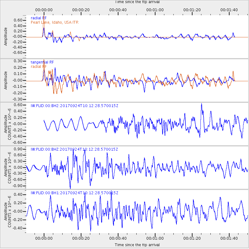
PLID Pearl Lake, Idaho, USA - Earthquake Result Viewer
*The percent match for this event was below the threshold and hence no stack was calculated.
| Earthquake location: |
Near Coast Of Oaxaca, Mexico |
| Earthquake latitude/longitude: |
15.3/-94.1 |
| Earthquake time(UTC): |
2017/09/24 (267) 10:06:12 GMT |
| Earthquake Depth: |
55 km |
| Earthquake Magnitude: |
5.8 Mww |
| Earthquake Catalog/Contributor: |
NEIC PDE/us |
|
| Network: |
IW Intermountain West |
| Station: |
PLID Pearl Lake, Idaho, USA |
| Lat/Lon: |
45.09 N/116.00 W |
| Elevation: |
2164 m |
|
| Distance: |
34.9 deg |
| Az: |
332.532 deg |
| Baz: |
141.08 deg |
| Ray Param: |
$rayparam |
*The percent match for this event was below the threshold and hence was not used in the summary stack. |
|
| Radial Match: |
64.05328 % |
| Radial Bump: |
400 |
| Transverse Match: |
85.28749 % |
| Transverse Bump: |
400 |
| SOD ConfigId: |
2364251 |
| Insert Time: |
2017-10-09 20:49:44.717 +0000 |
| GWidth: |
2.5 |
| Max Bumps: |
400 |
| Tol: |
0.001 |
|
Signal To Noise
| Channel | StoN | STA | LTA |
| IW:PLID:00:BHZ:20170924T10:12:28.570015Z | 3.082922 | 2.7079452E-7 | 8.7836966E-8 |
| IW:PLID:00:BH1:20170924T10:12:28.570015Z | 1.5798211 | 1.42461E-7 | 9.0175405E-8 |
| IW:PLID:00:BH2:20170924T10:12:28.570015Z | 0.78408134 | 9.4821594E-8 | 1.2093336E-7 |
| Arrivals |
| Ps | |
| PpPs | |
| PsPs/PpSs | |


