You are here: Home > Network List > IW - Intermountain West Stations List
> Station PLID Pearl Lake, Idaho, USA > Earthquake Result Viewer
PLID Pearl Lake, Idaho, USA - Earthquake Result Viewer
*The percent match for this event was below the threshold and hence no stack was calculated.
| Earthquake location: |
Andreanof Islands, Aleutian Is. |
| Earthquake latitude/longitude: |
51.2/-179.8 |
| Earthquake time(UTC): |
2021/01/03 (003) 12:38:48 GMT |
| Earthquake Depth: |
17 km |
| Earthquake Magnitude: |
6.1 Mww |
| Earthquake Catalog/Contributor: |
NEIC PDE/us |
|
| Network: |
IW Intermountain West |
| Station: |
PLID Pearl Lake, Idaho, USA |
| Lat/Lon: |
45.09 N/116.00 W |
| Elevation: |
2164 m |
|
| Distance: |
41.8 deg |
| Az: |
72.417 deg |
| Baz: |
302.122 deg |
| Ray Param: |
$rayparam |
*The percent match for this event was below the threshold and hence was not used in the summary stack. |
|
| Radial Match: |
65.33366 % |
| Radial Bump: |
355 |
| Transverse Match: |
52.243454 % |
| Transverse Bump: |
400 |
| SOD ConfigId: |
23341671 |
| Insert Time: |
2021-01-17 13:48:55.991 +0000 |
| GWidth: |
2.5 |
| Max Bumps: |
400 |
| Tol: |
0.001 |
|
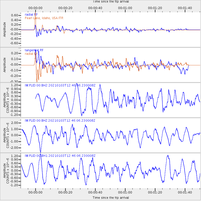
Signal To Noise
| Channel | StoN | STA | LTA |
| IW:PLID:00:BHZ:20210103T12:46:06.230008Z | 2.7883363 | 1.3729355E-6 | 4.923852E-7 |
| IW:PLID:00:BH1:20210103T12:46:06.230008Z | 2.3966641 | 7.870585E-7 | 3.283975E-7 |
| IW:PLID:00:BH2:20210103T12:46:06.230008Z | 1.7245984 | 7.714518E-7 | 4.473226E-7 |
| Arrivals |
| Ps | |
| PpPs | |
| PsPs/PpSs | |


