You are here: Home > Network List > TA - USArray Transportable Network (new EarthScope stations) Stations List
> Station A36M Sachs Harbour, NT, CAN > Earthquake Result Viewer
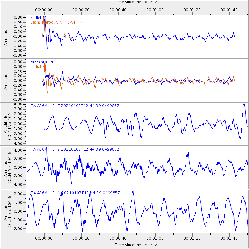
A36M Sachs Harbour, NT, CAN - Earthquake Result Viewer
*The percent match for this event was below the threshold and hence no stack was calculated.
| Earthquake location: |
Andreanof Islands, Aleutian Is. |
| Earthquake latitude/longitude: |
51.2/-179.8 |
| Earthquake time(UTC): |
2021/01/03 (003) 12:38:48 GMT |
| Earthquake Depth: |
17 km |
| Earthquake Magnitude: |
6.1 Mww |
| Earthquake Catalog/Contributor: |
NEIC PDE/us |
|
| Network: |
TA USArray Transportable Network (new EarthScope stations) |
| Station: |
A36M Sachs Harbour, NT, CAN |
| Lat/Lon: |
71.99 N/125.25 W |
| Elevation: |
32 m |
|
| Distance: |
31.6 deg |
| Az: |
28.969 deg |
| Baz: |
258.455 deg |
| Ray Param: |
$rayparam |
*The percent match for this event was below the threshold and hence was not used in the summary stack. |
|
| Radial Match: |
58.598927 % |
| Radial Bump: |
400 |
| Transverse Match: |
84.64224 % |
| Transverse Bump: |
354 |
| SOD ConfigId: |
23341671 |
| Insert Time: |
2021-01-17 13:58:02.470 +0000 |
| GWidth: |
2.5 |
| Max Bumps: |
400 |
| Tol: |
0.001 |
|
Signal To Noise
| Channel | StoN | STA | LTA |
| TA:A36M: :BHZ:20210103T12:44:39.049985Z | 2.3338802 | 1.6865577E-6 | 7.2264106E-7 |
| TA:A36M: :BHN:20210103T12:44:39.049985Z | 0.65145576 | 7.6079476E-7 | 1.1678379E-6 |
| TA:A36M: :BHE:20210103T12:44:39.049985Z | 1.265007 | 1.1128265E-6 | 8.796999E-7 |
| Arrivals |
| Ps | |
| PpPs | |
| PsPs/PpSs | |


