You are here: Home > Network List > US - United States National Seismic Network Stations List
> Station HAWA Hanford, Washington, USA > Earthquake Result Viewer
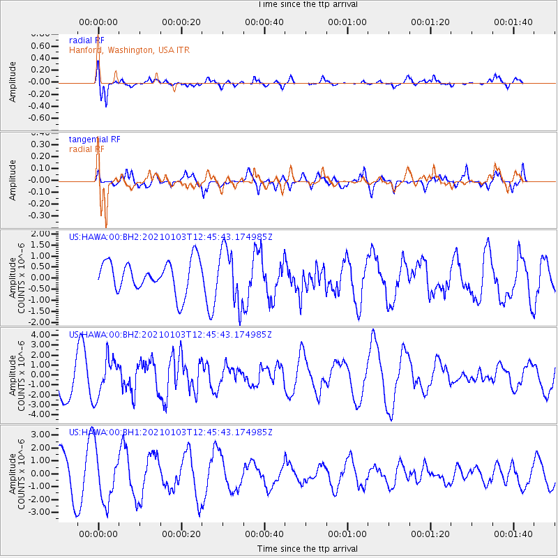
HAWA Hanford, Washington, USA - Earthquake Result Viewer
*The percent match for this event was below the threshold and hence no stack was calculated.
| Earthquake location: |
Andreanof Islands, Aleutian Is. |
| Earthquake latitude/longitude: |
51.2/-179.8 |
| Earthquake time(UTC): |
2021/01/03 (003) 12:38:48 GMT |
| Earthquake Depth: |
17 km |
| Earthquake Magnitude: |
6.1 Mww |
| Earthquake Catalog/Contributor: |
NEIC PDE/us |
|
| Network: |
US United States National Seismic Network |
| Station: |
HAWA Hanford, Washington, USA |
| Lat/Lon: |
46.39 N/119.53 W |
| Elevation: |
364 m |
|
| Distance: |
39.0 deg |
| Az: |
72.653 deg |
| Baz: |
299.78 deg |
| Ray Param: |
$rayparam |
*The percent match for this event was below the threshold and hence was not used in the summary stack. |
|
| Radial Match: |
72.681114 % |
| Radial Bump: |
400 |
| Transverse Match: |
64.34491 % |
| Transverse Bump: |
400 |
| SOD ConfigId: |
23341671 |
| Insert Time: |
2021-01-17 14:00:02.926 +0000 |
| GWidth: |
2.5 |
| Max Bumps: |
400 |
| Tol: |
0.001 |
|
Signal To Noise
| Channel | StoN | STA | LTA |
| US:HAWA:00:BHZ:20210103T12:45:43.174985Z | 0.97604704 | 1.8574457E-6 | 1.9030289E-6 |
| US:HAWA:00:BH1:20210103T12:45:43.174985Z | 1.567899 | 1.8611132E-6 | 1.1870109E-6 |
| US:HAWA:00:BH2:20210103T12:45:43.174985Z | 1.8097693 | 1.2617696E-6 | 6.9719914E-7 |
| Arrivals |
| Ps | |
| PpPs | |
| PsPs/PpSs | |


