You are here: Home > Network List > US - United States National Seismic Network Stations List
> Station MSO Missoula, Montana, USA > Earthquake Result Viewer
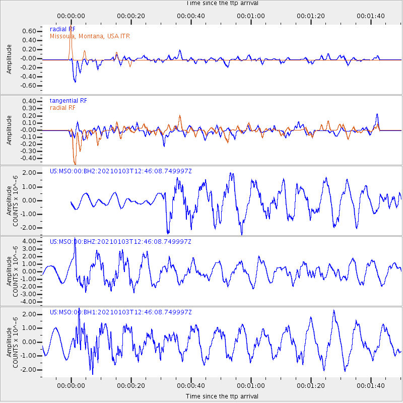
MSO Missoula, Montana, USA - Earthquake Result Viewer
*The percent match for this event was below the threshold and hence no stack was calculated.
| Earthquake location: |
Andreanof Islands, Aleutian Is. |
| Earthquake latitude/longitude: |
51.2/-179.8 |
| Earthquake time(UTC): |
2021/01/03 (003) 12:38:48 GMT |
| Earthquake Depth: |
17 km |
| Earthquake Magnitude: |
6.1 Mww |
| Earthquake Catalog/Contributor: |
NEIC PDE/us |
|
| Network: |
US United States National Seismic Network |
| Station: |
MSO Missoula, Montana, USA |
| Lat/Lon: |
46.83 N/113.94 W |
| Elevation: |
1264 m |
|
| Distance: |
42.1 deg |
| Az: |
69.074 deg |
| Baz: |
301.113 deg |
| Ray Param: |
$rayparam |
*The percent match for this event was below the threshold and hence was not used in the summary stack. |
|
| Radial Match: |
83.79398 % |
| Radial Bump: |
400 |
| Transverse Match: |
60.395977 % |
| Transverse Bump: |
400 |
| SOD ConfigId: |
23341671 |
| Insert Time: |
2021-01-17 14:00:16.549 +0000 |
| GWidth: |
2.5 |
| Max Bumps: |
400 |
| Tol: |
0.001 |
|
Signal To Noise
| Channel | StoN | STA | LTA |
| US:MSO:00:BHZ:20210103T12:46:08.749997Z | 3.0728054 | 1.7678918E-6 | 5.7533475E-7 |
| US:MSO:00:BH1:20210103T12:46:08.749997Z | 1.4437622 | 8.768114E-7 | 6.0731014E-7 |
| US:MSO:00:BH2:20210103T12:46:08.749997Z | 3.5093932 | 1.089141E-6 | 3.1035026E-7 |
| Arrivals |
| Ps | |
| PpPs | |
| PsPs/PpSs | |


