You are here: Home > Network List > XW97 - Tien Shan Continental Dynamics Stations List
> Station AKSU XW.AKSU > Earthquake Result Viewer
AKSU XW.AKSU - Earthquake Result Viewer

| Earthquake location: |
Southern Sumatra, Indonesia |
| Earthquake latitude/longitude: |
-4.9/102.7 |
| Earthquake time(UTC): |
2000/06/05 (157) 06:34:11 GMT |
| Earthquake Depth: |
33 km |
| Earthquake Magnitude: |
5.4 MB, 5.5 MS, 5.8 MW |
| Earthquake Catalog/Contributor: |
WHDF/NEIC |
|
| Network: |
XW Tien Shan Continental Dynamics |
| Station: |
AKSU XW.AKSU |
| Lat/Lon: |
41.14 N/80.11 E |
| Elevation: |
1109 m |
|
| Distance: |
50.3 deg |
| Az: |
337.878 deg |
| Baz: |
150.21 deg |
| Ray Param: |
0.06811053 |
| Estimated Moho Depth: |
13.5 km |
| Estimated Crust Vp/Vs: |
2.10 |
| Assumed Crust Vp: |
6.129 km/s |
| Estimated Crust Vs: |
2.925 km/s |
| Estimated Crust Poisson's Ratio: |
0.35 |
|
| Radial Match: |
93.70908 % |
| Radial Bump: |
386 |
| Transverse Match: |
82.04198 % |
| Transverse Bump: |
400 |
| SOD ConfigId: |
20082 |
| Insert Time: |
2010-02-26 15:14:17.838 +0000 |
| GWidth: |
2.5 |
| Max Bumps: |
400 |
| Tol: |
0.001 |
|
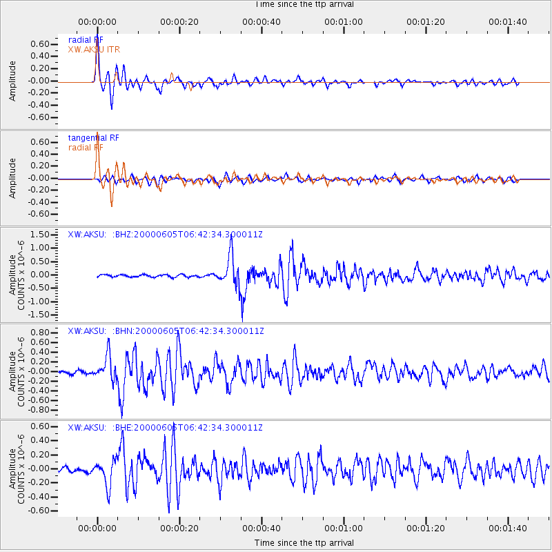
Signal To Noise
| Channel | StoN | STA | LTA |
| XW:AKSU: :BHN:20000605T06:42:34.300011Z | 9.633676 | 2.6038356E-7 | 2.7028474E-8 |
| XW:AKSU: :BHE:20000605T06:42:34.300011Z | 7.192359 | 1.8554422E-7 | 2.5797409E-8 |
| XW:AKSU: :BHZ:20000605T06:42:34.300011Z | 13.514795 | 5.7761355E-7 | 4.2739348E-8 |
| Arrivals |
| Ps | 2.5 SECOND |
| PpPs | 6.5 SECOND |
| PsPs/PpSs | 9.0 SECOND |


