You are here: Home > Network List > GO - National Seismic Network of Georgia Stations List
> Station TBLG Delisi, Georgia > Earthquake Result Viewer
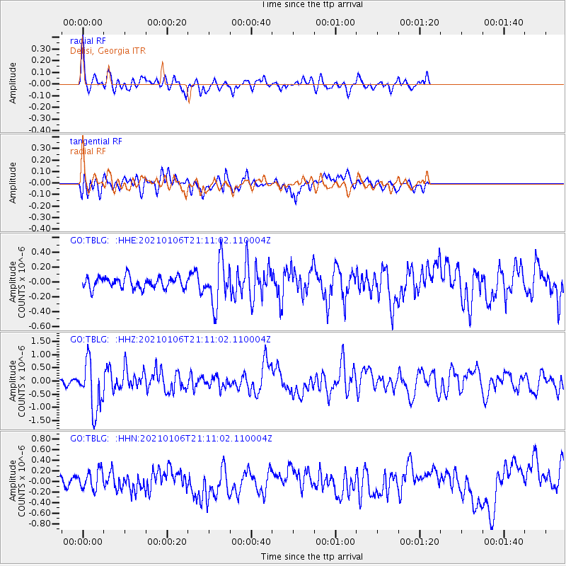
TBLG Delisi, Georgia - Earthquake Result Viewer
*The percent match for this event was below the threshold and hence no stack was calculated.
| Earthquake location: |
Minahassa Peninsula, Sulawesi |
| Earthquake latitude/longitude: |
0.0/122.9 |
| Earthquake time(UTC): |
2021/01/06 (006) 20:59:35 GMT |
| Earthquake Depth: |
157 km |
| Earthquake Magnitude: |
6.1 mww |
| Earthquake Catalog/Contributor: |
NEIC PDE/us |
|
| Network: |
GO National Seismic Network of Georgia |
| Station: |
TBLG Delisi, Georgia |
| Lat/Lon: |
41.73 N/44.74 E |
| Elevation: |
510 m |
|
| Distance: |
81.2 deg |
| Az: |
312.148 deg |
| Baz: |
97.884 deg |
| Ray Param: |
$rayparam |
*The percent match for this event was below the threshold and hence was not used in the summary stack. |
|
| Radial Match: |
78.1711 % |
| Radial Bump: |
400 |
| Transverse Match: |
53.47725 % |
| Transverse Bump: |
400 |
| SOD ConfigId: |
23341671 |
| Insert Time: |
2021-01-20 22:04:45.000 +0000 |
| GWidth: |
2.5 |
| Max Bumps: |
400 |
| Tol: |
0.001 |
|
Signal To Noise
| Channel | StoN | STA | LTA |
| GO:TBLG: :HHZ:20210106T21:11:02.110004Z | 6.6726685 | 9.553736E-7 | 1.4317715E-7 |
| GO:TBLG: :HHN:20210106T21:11:02.110004Z | 1.415166 | 1.9139536E-7 | 1.3524586E-7 |
| GO:TBLG: :HHE:20210106T21:11:02.110004Z | 3.9281 | 3.0033863E-7 | 7.645901E-8 |
| Arrivals |
| Ps | |
| PpPs | |
| PsPs/PpSs | |


