You are here: Home > Network List > G - GEOSCOPE Stations List
> Station UNM Unam,Mexico > Earthquake Result Viewer
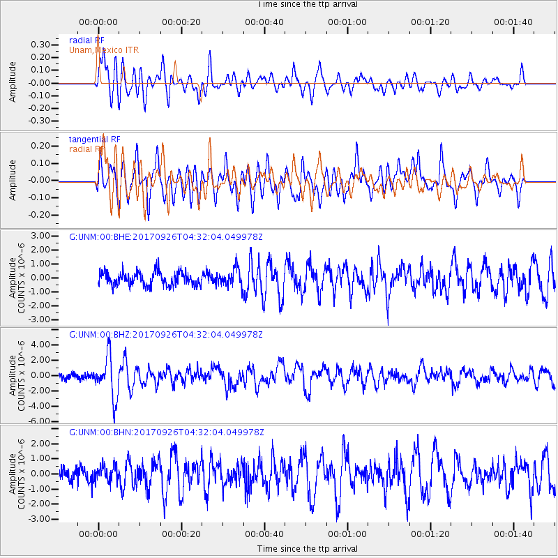
UNM Unam,Mexico - Earthquake Result Viewer
*The percent match for this event was below the threshold and hence no stack was calculated.
| Earthquake location: |
South Of Fiji Islands |
| Earthquake latitude/longitude: |
-23.7/-176.9 |
| Earthquake time(UTC): |
2017/09/26 (269) 04:20:00 GMT |
| Earthquake Depth: |
98 km |
| Earthquake Magnitude: |
6.4 mww |
| Earthquake Catalog/Contributor: |
NEIC PDE/us |
|
| Network: |
G GEOSCOPE |
| Station: |
UNM Unam,Mexico |
| Lat/Lon: |
19.33 N/99.18 W |
| Elevation: |
2280 m |
|
| Distance: |
87.0 deg |
| Az: |
67.533 deg |
| Baz: |
243.757 deg |
| Ray Param: |
$rayparam |
*The percent match for this event was below the threshold and hence was not used in the summary stack. |
|
| Radial Match: |
75.6498 % |
| Radial Bump: |
400 |
| Transverse Match: |
69.18424 % |
| Transverse Bump: |
400 |
| SOD ConfigId: |
2364251 |
| Insert Time: |
2017-10-10 04:21:39.763 +0000 |
| GWidth: |
2.5 |
| Max Bumps: |
400 |
| Tol: |
0.001 |
|
Signal To Noise
| Channel | StoN | STA | LTA |
| G:UNM:00:BHZ:20170926T04:32:04.049978Z | 7.4647813 | 2.8014267E-6 | 3.7528582E-7 |
| G:UNM:00:BHN:20170926T04:32:04.049978Z | 0.9361195 | 5.1397774E-7 | 5.4905144E-7 |
| G:UNM:00:BHE:20170926T04:32:04.049978Z | 1.3265945 | 6.3280345E-7 | 4.770135E-7 |
| Arrivals |
| Ps | |
| PpPs | |
| PsPs/PpSs | |


