You are here: Home > Network List > GM - US Geological Survey Networks Stations List
> Station IWM01 Jericho 2M Well Monitoring Station > Earthquake Result Viewer
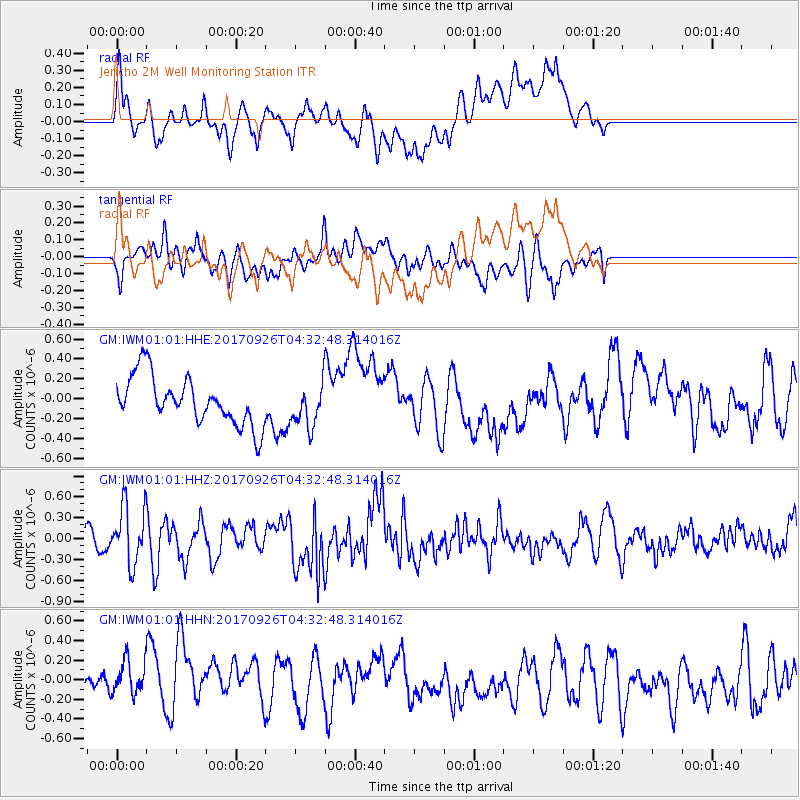
IWM01 Jericho 2M Well Monitoring Station - Earthquake Result Viewer
*The percent match for this event was below the threshold and hence no stack was calculated.
| Earthquake location: |
South Of Fiji Islands |
| Earthquake latitude/longitude: |
-23.7/-176.9 |
| Earthquake time(UTC): |
2017/09/26 (269) 04:20:00 GMT |
| Earthquake Depth: |
98 km |
| Earthquake Magnitude: |
6.4 mww |
| Earthquake Catalog/Contributor: |
NEIC PDE/us |
|
| Network: |
GM US Geological Survey Networks |
| Station: |
IWM01 Jericho 2M Well Monitoring Station |
| Lat/Lon: |
36.73 N/96.53 W |
| Elevation: |
328 m |
|
| Distance: |
96.6 deg |
| Az: |
52.892 deg |
| Baz: |
245.479 deg |
| Ray Param: |
$rayparam |
*The percent match for this event was below the threshold and hence was not used in the summary stack. |
|
| Radial Match: |
44.339336 % |
| Radial Bump: |
400 |
| Transverse Match: |
45.95212 % |
| Transverse Bump: |
400 |
| SOD ConfigId: |
2364251 |
| Insert Time: |
2017-10-10 04:21:43.796 +0000 |
| GWidth: |
2.5 |
| Max Bumps: |
400 |
| Tol: |
0.001 |
|
Signal To Noise
| Channel | StoN | STA | LTA |
| GM:IWM01:01:HHZ:20170926T04:32:48.314016Z | 1.7956246 | 4.1696796E-7 | 2.3221334E-7 |
| GM:IWM01:01:HHN:20170926T04:32:48.314016Z | 1.2059773 | 2.216363E-7 | 1.837815E-7 |
| GM:IWM01:01:HHE:20170926T04:32:48.314016Z | 0.89125794 | 2.1464196E-7 | 2.4083033E-7 |
| Arrivals |
| Ps | |
| PpPs | |
| PsPs/PpSs | |


