You are here: Home > Network List > GS - US Geological Survey Networks Stations List
> Station KAN10 Keim Farm > Earthquake Result Viewer
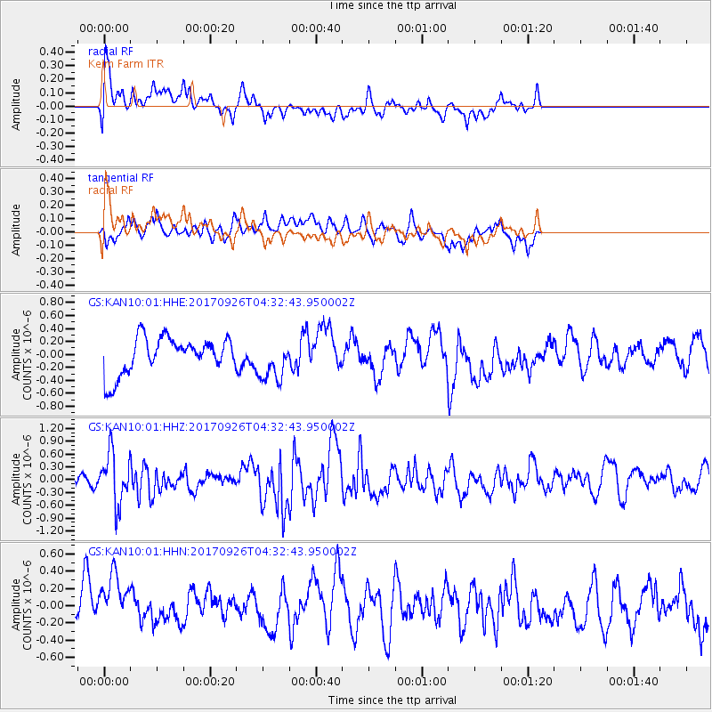
KAN10 Keim Farm - Earthquake Result Viewer
*The percent match for this event was below the threshold and hence no stack was calculated.
| Earthquake location: |
South Of Fiji Islands |
| Earthquake latitude/longitude: |
-23.7/-176.9 |
| Earthquake time(UTC): |
2017/09/26 (269) 04:20:00 GMT |
| Earthquake Depth: |
98 km |
| Earthquake Magnitude: |
6.4 mww |
| Earthquake Catalog/Contributor: |
NEIC PDE/us |
|
| Network: |
GS US Geological Survey Networks |
| Station: |
KAN10 Keim Farm |
| Lat/Lon: |
37.12 N/98.10 W |
| Elevation: |
417 m |
|
| Distance: |
95.7 deg |
| Az: |
52.0 deg |
| Baz: |
244.639 deg |
| Ray Param: |
$rayparam |
*The percent match for this event was below the threshold and hence was not used in the summary stack. |
|
| Radial Match: |
43.74793 % |
| Radial Bump: |
400 |
| Transverse Match: |
43.628212 % |
| Transverse Bump: |
400 |
| SOD ConfigId: |
2364251 |
| Insert Time: |
2017-10-10 04:22:08.725 +0000 |
| GWidth: |
2.5 |
| Max Bumps: |
400 |
| Tol: |
0.001 |
|
Signal To Noise
| Channel | StoN | STA | LTA |
| GS:KAN10:01:HHZ:20170926T04:32:43.950002Z | 3.0889578 | 5.955113E-7 | 1.9278714E-7 |
| GS:KAN10:01:HHN:20170926T04:32:43.950002Z | 2.0376244 | 4.203352E-7 | 2.062869E-7 |
| GS:KAN10:01:HHE:20170926T04:32:43.950002Z | 1.1401933 | 3.2003635E-7 | 2.8068604E-7 |
| Arrivals |
| Ps | |
| PpPs | |
| PsPs/PpSs | |


