You are here: Home > Network List > CI - Caltech Regional Seismic Network Stations List
> Station LRL Laurel Mtn Radio Fac, Ridgecrest, CA, USA > Earthquake Result Viewer
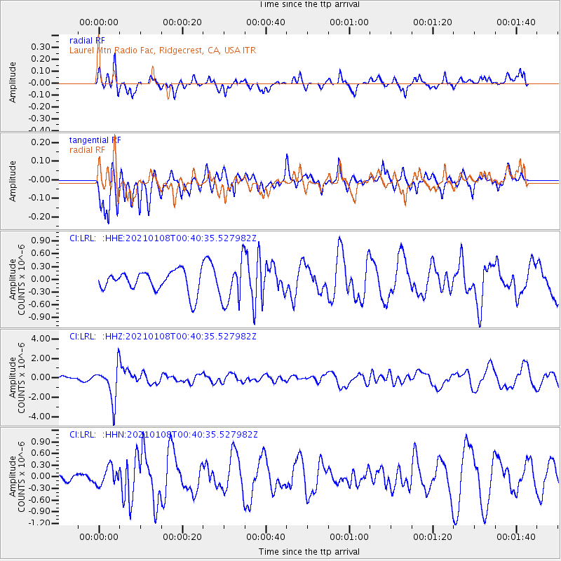
LRL Laurel Mtn Radio Fac, Ridgecrest, CA, USA - Earthquake Result Viewer
*The percent match for this event was below the threshold and hence no stack was calculated.
| Earthquake location: |
Kermadec Islands, New Zealand |
| Earthquake latitude/longitude: |
-29.4/-178.8 |
| Earthquake time(UTC): |
2021/01/08 (008) 00:28:49 GMT |
| Earthquake Depth: |
222 km |
| Earthquake Magnitude: |
6.3 mww |
| Earthquake Catalog/Contributor: |
NEIC PDE/us |
|
| Network: |
CI Caltech Regional Seismic Network |
| Station: |
LRL Laurel Mtn Radio Fac, Ridgecrest, CA, USA |
| Lat/Lon: |
35.48 N/117.68 W |
| Elevation: |
1340 m |
|
| Distance: |
86.4 deg |
| Az: |
45.706 deg |
| Baz: |
229.927 deg |
| Ray Param: |
$rayparam |
*The percent match for this event was below the threshold and hence was not used in the summary stack. |
|
| Radial Match: |
53.51634 % |
| Radial Bump: |
350 |
| Transverse Match: |
50.320404 % |
| Transverse Bump: |
400 |
| SOD ConfigId: |
23341671 |
| Insert Time: |
2021-01-22 01:37:56.735 +0000 |
| GWidth: |
2.5 |
| Max Bumps: |
400 |
| Tol: |
0.001 |
|
Signal To Noise
| Channel | StoN | STA | LTA |
| CI:LRL: :HHZ:20210108T00:40:35.527982Z | 13.68241 | 1.8168732E-6 | 1.3278897E-7 |
| CI:LRL: :HHN:20210108T00:40:35.527982Z | 1.0263903 | 2.3346962E-7 | 2.2746669E-7 |
| CI:LRL: :HHE:20210108T00:40:35.527982Z | 1.9963763 | 4.9386813E-7 | 2.473823E-7 |
| Arrivals |
| Ps | |
| PpPs | |
| PsPs/PpSs | |


