
AKSU XW.AKSU - Earthquake Result Viewer
| ||||||||||||||||||
| ||||||||||||||||||
| ||||||||||||||||||
|
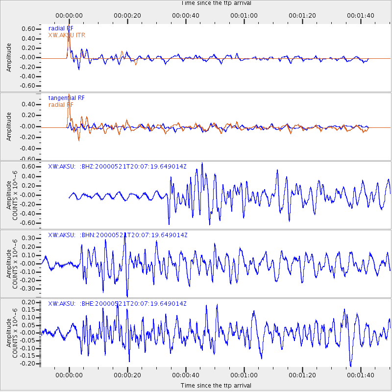
Signal To Noise
| Channel | StoN | STA | LTA |
| XW:AKSU: :BHN:20000521T20:07:19.649014Z | 1.8710873 | 6.877502E-8 | 3.6756713E-8 |
| XW:AKSU: :BHE:20000521T20:07:19.649014Z | 2.329554 | 4.876909E-8 | 2.0934946E-8 |
| XW:AKSU: :BHZ:20000521T20:07:19.649014Z | 3.9050107 | 1.7165607E-7 | 4.3957897E-8 |
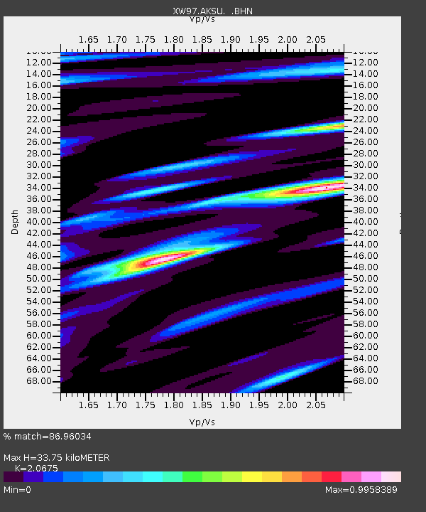
| Arrivals | |
| Ps | 6.1 SECOND |
| PpPs | 16 SECOND |
| PsPs/PpSs | 22 SECOND |

