You are here: Home > Network List > US - United States National Seismic Network Stations List
> Station AMTX Amarillo, Texas, USA > Earthquake Result Viewer
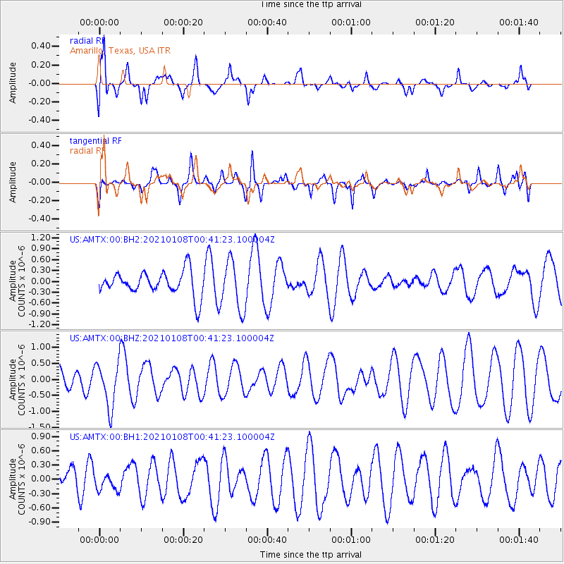
AMTX Amarillo, Texas, USA - Earthquake Result Viewer
*The percent match for this event was below the threshold and hence no stack was calculated.
| Earthquake location: |
Kermadec Islands, New Zealand |
| Earthquake latitude/longitude: |
-29.4/-178.8 |
| Earthquake time(UTC): |
2021/01/08 (008) 00:28:49 GMT |
| Earthquake Depth: |
222 km |
| Earthquake Magnitude: |
6.3 mww |
| Earthquake Catalog/Contributor: |
NEIC PDE/us |
|
| Network: |
US United States National Seismic Network |
| Station: |
AMTX Amarillo, Texas, USA |
| Lat/Lon: |
34.53 N/101.41 W |
| Elevation: |
1010 m |
|
| Distance: |
96.8 deg |
| Az: |
54.216 deg |
| Baz: |
239.023 deg |
| Ray Param: |
$rayparam |
*The percent match for this event was below the threshold and hence was not used in the summary stack. |
|
| Radial Match: |
85.257835 % |
| Radial Bump: |
400 |
| Transverse Match: |
73.353325 % |
| Transverse Bump: |
400 |
| SOD ConfigId: |
23341671 |
| Insert Time: |
2021-01-22 01:46:18.047 +0000 |
| GWidth: |
2.5 |
| Max Bumps: |
400 |
| Tol: |
0.001 |
|
Signal To Noise
| Channel | StoN | STA | LTA |
| US:AMTX:00:BHZ:20210108T00:41:23.100004Z | 1.5806718 | 7.1347057E-7 | 4.513717E-7 |
| US:AMTX:00:BH1:20210108T00:41:23.100004Z | 0.7242202 | 2.0581962E-7 | 2.841948E-7 |
| US:AMTX:00:BH2:20210108T00:41:23.100004Z | 2.0491672 | 6.8197494E-7 | 3.328059E-7 |
| Arrivals |
| Ps | |
| PpPs | |
| PsPs/PpSs | |


