You are here: Home > Network List > IW - Intermountain West Stations List
> Station MOOW Moose Ponds, Wyoming, USA > Earthquake Result Viewer
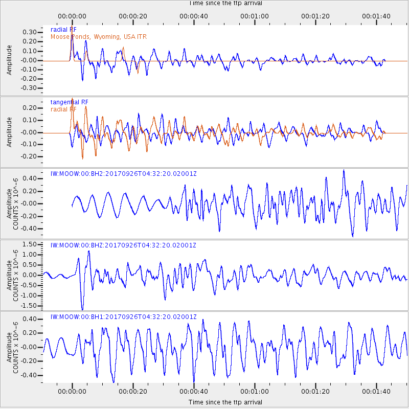
MOOW Moose Ponds, Wyoming, USA - Earthquake Result Viewer
*The percent match for this event was below the threshold and hence no stack was calculated.
| Earthquake location: |
South Of Fiji Islands |
| Earthquake latitude/longitude: |
-23.7/-176.9 |
| Earthquake time(UTC): |
2017/09/26 (269) 04:20:00 GMT |
| Earthquake Depth: |
98 km |
| Earthquake Magnitude: |
6.4 mww |
| Earthquake Catalog/Contributor: |
NEIC PDE/us |
|
| Network: |
IW Intermountain West |
| Station: |
MOOW Moose Ponds, Wyoming, USA |
| Lat/Lon: |
43.75 N/110.74 W |
| Elevation: |
2128 m |
|
| Distance: |
90.4 deg |
| Az: |
41.532 deg |
| Baz: |
236.991 deg |
| Ray Param: |
$rayparam |
*The percent match for this event was below the threshold and hence was not used in the summary stack. |
|
| Radial Match: |
79.45232 % |
| Radial Bump: |
400 |
| Transverse Match: |
62.93041 % |
| Transverse Bump: |
374 |
| SOD ConfigId: |
2364251 |
| Insert Time: |
2017-10-10 04:24:15.465 +0000 |
| GWidth: |
2.5 |
| Max Bumps: |
400 |
| Tol: |
0.001 |
|
Signal To Noise
| Channel | StoN | STA | LTA |
| IW:MOOW:00:BHZ:20170926T04:32:20.02001Z | 7.14324 | 6.904304E-7 | 9.665508E-8 |
| IW:MOOW:00:BH1:20170926T04:32:20.02001Z | 1.4506116 | 1.1326232E-7 | 7.8079005E-8 |
| IW:MOOW:00:BH2:20170926T04:32:20.02001Z | 0.631714 | 7.2828186E-8 | 1.15286646E-7 |
| Arrivals |
| Ps | |
| PpPs | |
| PsPs/PpSs | |


