AKSU XW.AKSU - Earthquake Result Viewer
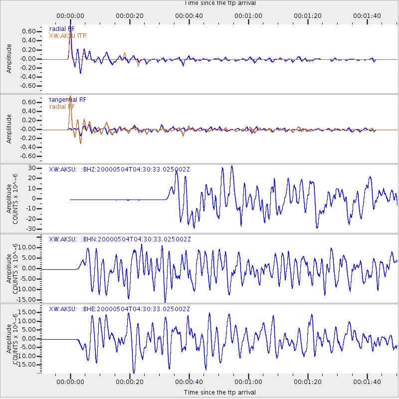
Earthquake location: Sulawesi, Indonesia
Earthquake latitude/longitude: -1.1/123.6
Earthquake time(UTC): 2000/05/04 (125) 04:21:16 GMT
Earthquake Depth: 26 km
Earthquake Magnitude: 6.7 MB, 7.5 MS, 7.6 MW, 7.5 ME
Earthquake Catalog/Contributor: WHDF/NEIC
Network: XW Tien Shan Continental Dynamics
Station: AKSU XW.AKSU
Lat/Lon: 41.14 N/80.11 E
Elevation: 1109 m
Distance: 57.6 deg
Az: 322.036 deg
Baz: 125.474 deg
Ray Param: 0.06333548
Estimated Moho Depth: 13.25 km
Estimated Crust Vp/Vs: 2.08
Assumed Crust Vp: 6.129 km/s
Estimated Crust Vs: 2.954 km/s
Estimated Crust Poisson's Ratio: 0.35
Radial Match: 97.89154 %
Radial Bump: 286
Transverse Match: 92.87187 %
Transverse Bump: 400
SOD ConfigId: 20082
Insert Time: 2010-02-26 15:14:30.771 +0000
GWidth: 2.5
Max Bumps: 400
Tol: 0.001

Signal To Noise

ChannelStoNSTALTA
XW:AKSU: :BHN:20000504T04:30:33.025002Z41.5122571.8348667E-64.42006E-8
XW:AKSU: :BHE:20000504T04:30:33.025002Z51.4380262.3126258E-64.495946E-8
XW:AKSU: :BHZ:20000504T04:30:33.025002Z74.4385455.335149E-67.1671856E-8
Arrivals
Ps2.4 SECOND
PpPs6.4 SECOND
PsPs/PpSs8.8 SECOND