You are here: Home > Network List > AV - Alaska Volcano Observatory Stations List
> Station MAPS Pakushin Southeast, Makushin Volcano, Alaska > Earthquake Result Viewer
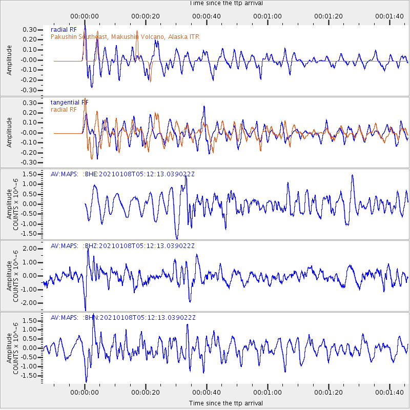
MAPS Pakushin Southeast, Makushin Volcano, Alaska - Earthquake Result Viewer
*The percent match for this event was below the threshold and hence no stack was calculated.
| Earthquake location: |
Vanuatu Islands |
| Earthquake latitude/longitude: |
-20.7/169.9 |
| Earthquake time(UTC): |
2021/01/08 (008) 05:01:04 GMT |
| Earthquake Depth: |
118 km |
| Earthquake Magnitude: |
6.1 Mww |
| Earthquake Catalog/Contributor: |
NEIC PDE/us |
|
| Network: |
AV Alaska Volcano Observatory |
| Station: |
MAPS Pakushin Southeast, Makushin Volcano, Alaska |
| Lat/Lon: |
53.81 N/166.94 W |
| Elevation: |
333 m |
|
| Distance: |
76.9 deg |
| Az: |
13.868 deg |
| Baz: |
202.227 deg |
| Ray Param: |
$rayparam |
*The percent match for this event was below the threshold and hence was not used in the summary stack. |
|
| Radial Match: |
50.331013 % |
| Radial Bump: |
400 |
| Transverse Match: |
59.379063 % |
| Transverse Bump: |
400 |
| SOD ConfigId: |
23341671 |
| Insert Time: |
2021-01-22 06:06:28.086 +0000 |
| GWidth: |
2.5 |
| Max Bumps: |
400 |
| Tol: |
0.001 |
|
Signal To Noise
| Channel | StoN | STA | LTA |
| AV:MAPS: :BHZ:20210108T05:12:13.039022Z | 2.5608327 | 1.0781191E-6 | 4.2100334E-7 |
| AV:MAPS: :BHN:20210108T05:12:13.039022Z | 1.7651588 | 8.951418E-7 | 5.071169E-7 |
| AV:MAPS: :BHE:20210108T05:12:13.039022Z | 2.075657 | 9.863353E-7 | 4.751919E-7 |
| Arrivals |
| Ps | |
| PpPs | |
| PsPs/PpSs | |


