You are here: Home > Network List > TA - USArray Transportable Network (new EarthScope stations) Stations List
> Station E20K Nigu River, AK, USA > Earthquake Result Viewer
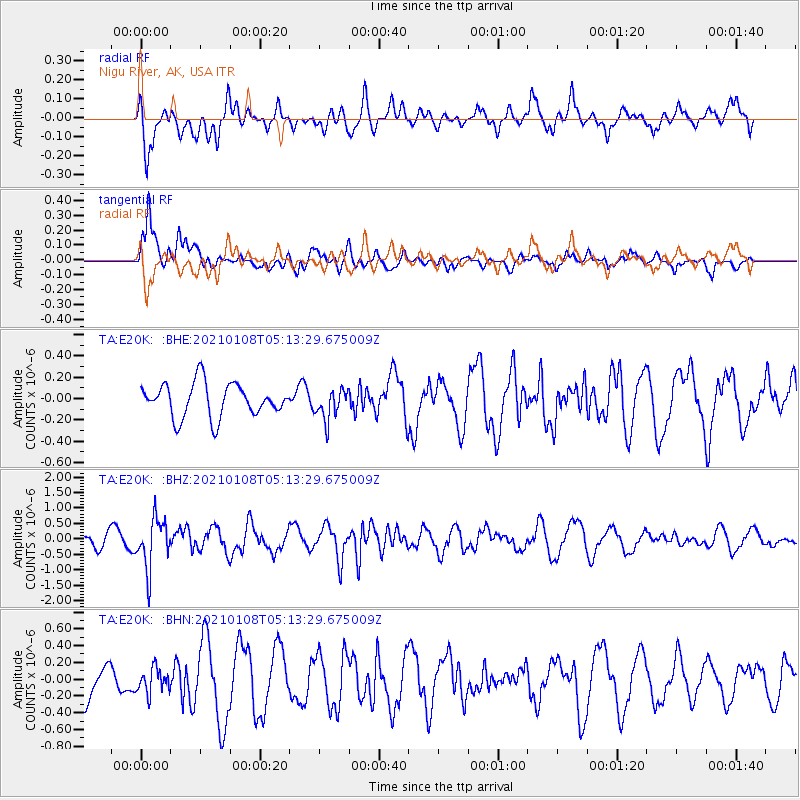
E20K Nigu River, AK, USA - Earthquake Result Viewer
*The percent match for this event was below the threshold and hence no stack was calculated.
| Earthquake location: |
Vanuatu Islands |
| Earthquake latitude/longitude: |
-20.7/169.9 |
| Earthquake time(UTC): |
2021/01/08 (008) 05:01:04 GMT |
| Earthquake Depth: |
118 km |
| Earthquake Magnitude: |
6.1 Mww |
| Earthquake Catalog/Contributor: |
NEIC PDE/us |
|
| Network: |
TA USArray Transportable Network (new EarthScope stations) |
| Station: |
E20K Nigu River, AK, USA |
| Lat/Lon: |
68.26 N/156.19 W |
| Elevation: |
866 m |
|
| Distance: |
92.1 deg |
| Az: |
12.012 deg |
| Baz: |
211.523 deg |
| Ray Param: |
$rayparam |
*The percent match for this event was below the threshold and hence was not used in the summary stack. |
|
| Radial Match: |
59.82695 % |
| Radial Bump: |
400 |
| Transverse Match: |
75.93829 % |
| Transverse Bump: |
400 |
| SOD ConfigId: |
23341671 |
| Insert Time: |
2021-01-22 06:16:31.154 +0000 |
| GWidth: |
2.5 |
| Max Bumps: |
400 |
| Tol: |
0.001 |
|
Signal To Noise
| Channel | StoN | STA | LTA |
| TA:E20K: :BHZ:20210108T05:13:29.675009Z | 3.283731 | 8.017215E-7 | 2.4414956E-7 |
| TA:E20K: :BHN:20210108T05:13:29.675009Z | 0.6177703 | 1.4349938E-7 | 2.3228598E-7 |
| TA:E20K: :BHE:20210108T05:13:29.675009Z | 0.90431684 | 1.4113789E-7 | 1.5607127E-7 |
| Arrivals |
| Ps | |
| PpPs | |
| PsPs/PpSs | |


