You are here: Home > Network List > TA - USArray Transportable Network (new EarthScope stations) Stations List
> Station G21K Allakaket, AK, USA > Earthquake Result Viewer
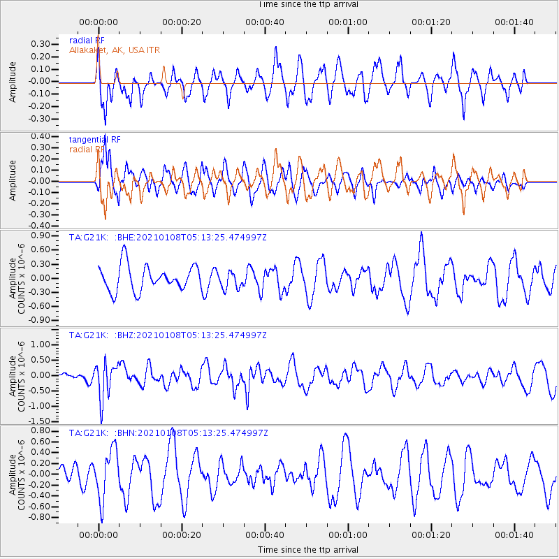
G21K Allakaket, AK, USA - Earthquake Result Viewer
*The percent match for this event was below the threshold and hence no stack was calculated.
| Earthquake location: |
Vanuatu Islands |
| Earthquake latitude/longitude: |
-20.7/169.9 |
| Earthquake time(UTC): |
2021/01/08 (008) 05:01:04 GMT |
| Earthquake Depth: |
118 km |
| Earthquake Magnitude: |
6.1 Mww |
| Earthquake Catalog/Contributor: |
NEIC PDE/us |
|
| Network: |
TA USArray Transportable Network (new EarthScope stations) |
| Station: |
G21K Allakaket, AK, USA |
| Lat/Lon: |
66.52 N/153.51 W |
| Elevation: |
446 m |
|
| Distance: |
91.2 deg |
| Az: |
13.832 deg |
| Baz: |
213.944 deg |
| Ray Param: |
$rayparam |
*The percent match for this event was below the threshold and hence was not used in the summary stack. |
|
| Radial Match: |
44.498608 % |
| Radial Bump: |
400 |
| Transverse Match: |
58.993317 % |
| Transverse Bump: |
400 |
| SOD ConfigId: |
23341671 |
| Insert Time: |
2021-01-22 06:16:47.723 +0000 |
| GWidth: |
2.5 |
| Max Bumps: |
400 |
| Tol: |
0.001 |
|
Signal To Noise
| Channel | StoN | STA | LTA |
| TA:G21K: :BHZ:20210108T05:13:25.474997Z | 4.4170265 | 5.860918E-7 | 1.3268922E-7 |
| TA:G21K: :BHN:20210108T05:13:25.474997Z | 1.7900293 | 4.7090907E-7 | 2.630734E-7 |
| TA:G21K: :BHE:20210108T05:13:25.474997Z | 0.6852764 | 1.8308208E-7 | 2.671653E-7 |
| Arrivals |
| Ps | |
| PpPs | |
| PsPs/PpSs | |


