You are here: Home > Network List > UW - Pacific Northwest Regional Seismic Network Stations List
> Station HOOD Mt Hood Meadows, OR CREST BB SMO > Earthquake Result Viewer
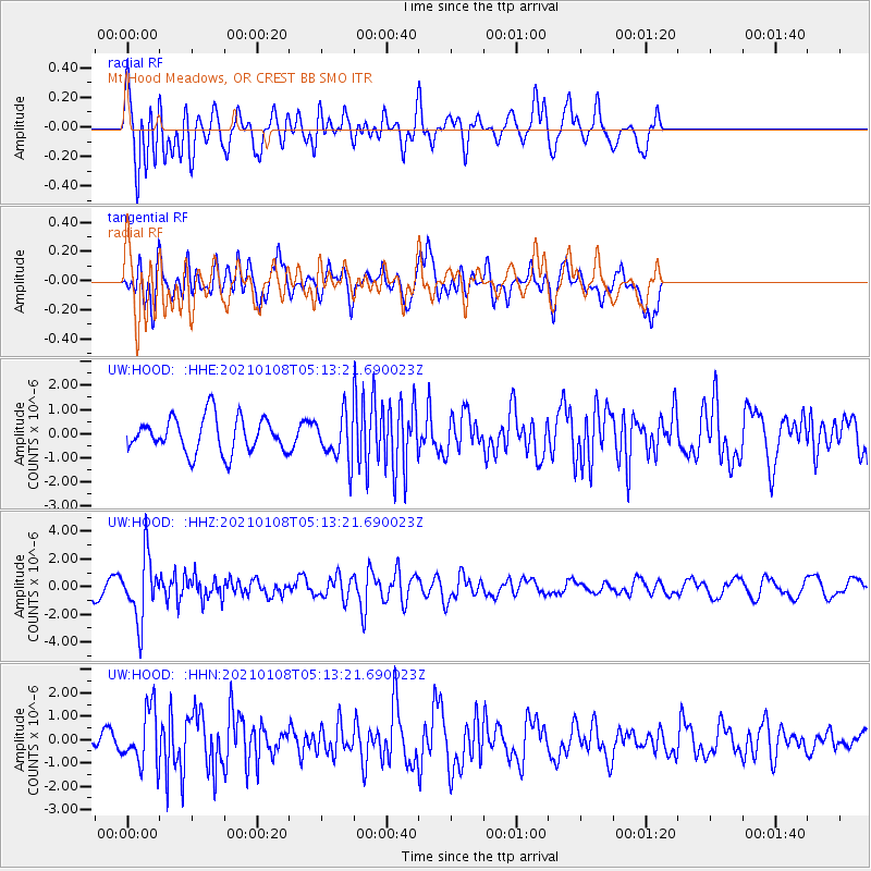
HOOD Mt Hood Meadows, OR CREST BB SMO - Earthquake Result Viewer
*The percent match for this event was below the threshold and hence no stack was calculated.
| Earthquake location: |
Vanuatu Islands |
| Earthquake latitude/longitude: |
-20.7/169.9 |
| Earthquake time(UTC): |
2021/01/08 (008) 05:01:04 GMT |
| Earthquake Depth: |
118 km |
| Earthquake Magnitude: |
6.1 Mww |
| Earthquake Catalog/Contributor: |
NEIC PDE/us |
|
| Network: |
UW Pacific Northwest Regional Seismic Network |
| Station: |
HOOD Mt Hood Meadows, OR CREST BB SMO |
| Lat/Lon: |
45.32 N/121.65 W |
| Elevation: |
1520 m |
|
| Distance: |
90.4 deg |
| Az: |
41.017 deg |
| Baz: |
240.54 deg |
| Ray Param: |
$rayparam |
*The percent match for this event was below the threshold and hence was not used in the summary stack. |
|
| Radial Match: |
59.89719 % |
| Radial Bump: |
400 |
| Transverse Match: |
61.230347 % |
| Transverse Bump: |
400 |
| SOD ConfigId: |
23341671 |
| Insert Time: |
2021-01-22 06:20:08.361 +0000 |
| GWidth: |
2.5 |
| Max Bumps: |
400 |
| Tol: |
0.001 |
|
Signal To Noise
| Channel | StoN | STA | LTA |
| UW:HOOD: :HHZ:20210108T05:13:21.690023Z | 4.434159 | 2.313998E-6 | 5.218573E-7 |
| UW:HOOD: :HHN:20210108T05:13:21.690023Z | 2.8446977 | 1.1821351E-6 | 4.1555734E-7 |
| UW:HOOD: :HHE:20210108T05:13:21.690023Z | 1.2958988 | 9.348575E-7 | 7.21397E-7 |
| Arrivals |
| Ps | |
| PpPs | |
| PsPs/PpSs | |


