You are here: Home > Network List > US - United States National Seismic Network Stations List
> Station EGMT Eagleton, Montana, USA > Earthquake Result Viewer
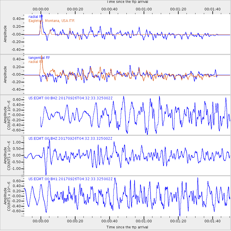
EGMT Eagleton, Montana, USA - Earthquake Result Viewer
*The percent match for this event was below the threshold and hence no stack was calculated.
| Earthquake location: |
South Of Fiji Islands |
| Earthquake latitude/longitude: |
-23.7/-176.9 |
| Earthquake time(UTC): |
2017/09/26 (269) 04:20:00 GMT |
| Earthquake Depth: |
98 km |
| Earthquake Magnitude: |
6.4 mww |
| Earthquake Catalog/Contributor: |
NEIC PDE/us |
|
| Network: |
US United States National Seismic Network |
| Station: |
EGMT Eagleton, Montana, USA |
| Lat/Lon: |
48.02 N/109.75 W |
| Elevation: |
1055 m |
|
| Distance: |
93.3 deg |
| Az: |
38.302 deg |
| Baz: |
237.805 deg |
| Ray Param: |
$rayparam |
*The percent match for this event was below the threshold and hence was not used in the summary stack. |
|
| Radial Match: |
62.868134 % |
| Radial Bump: |
400 |
| Transverse Match: |
59.651386 % |
| Transverse Bump: |
400 |
| SOD ConfigId: |
2364251 |
| Insert Time: |
2017-10-10 04:26:09.189 +0000 |
| GWidth: |
2.5 |
| Max Bumps: |
400 |
| Tol: |
0.001 |
|
Signal To Noise
| Channel | StoN | STA | LTA |
| US:EGMT:00:BHZ:20170926T04:32:33.325002Z | 4.159822 | 5.719891E-7 | 1.3750328E-7 |
| US:EGMT:00:BH1:20170926T04:32:33.325002Z | 1.8962524 | 3.7770175E-7 | 1.9918328E-7 |
| US:EGMT:00:BH2:20170926T04:32:33.325002Z | 1.8166999 | 3.3494072E-7 | 1.8436768E-7 |
| Arrivals |
| Ps | |
| PpPs | |
| PsPs/PpSs | |


