You are here: Home > Network List > US - United States National Seismic Network Stations List
> Station HAWA Hanford, Washington, USA > Earthquake Result Viewer
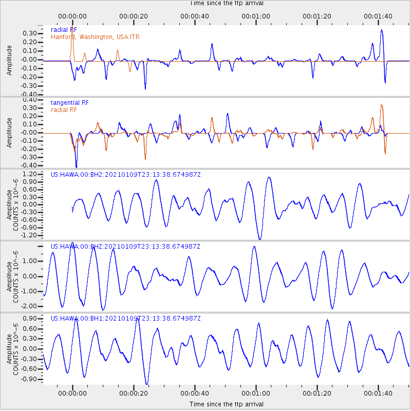
HAWA Hanford, Washington, USA - Earthquake Result Viewer
*The percent match for this event was below the threshold and hence no stack was calculated.
| Earthquake location: |
Solomon Islands |
| Earthquake latitude/longitude: |
-10.8/162.5 |
| Earthquake time(UTC): |
2021/01/09 (009) 23:01:12 GMT |
| Earthquake Depth: |
11 km |
| Earthquake Magnitude: |
5.3 Mww |
| Earthquake Catalog/Contributor: |
NEIC PDE/us |
|
| Network: |
US United States National Seismic Network |
| Station: |
HAWA Hanford, Washington, USA |
| Lat/Lon: |
46.39 N/119.53 W |
| Elevation: |
364 m |
|
| Distance: |
89.6 deg |
| Az: |
42.604 deg |
| Baz: |
253.901 deg |
| Ray Param: |
$rayparam |
*The percent match for this event was below the threshold and hence was not used in the summary stack. |
|
| Radial Match: |
76.79463 % |
| Radial Bump: |
400 |
| Transverse Match: |
66.59712 % |
| Transverse Bump: |
400 |
| SOD ConfigId: |
23341671 |
| Insert Time: |
2021-01-24 00:12:47.747 +0000 |
| GWidth: |
2.5 |
| Max Bumps: |
400 |
| Tol: |
0.001 |
|
Signal To Noise
| Channel | StoN | STA | LTA |
| US:HAWA:00:BHZ:20210109T23:13:38.674987Z | 2.657023 | 1.5544683E-6 | 5.850414E-7 |
| US:HAWA:00:BH1:20210109T23:13:38.674987Z | 1.3450153 | 5.9185305E-7 | 4.4003446E-7 |
| US:HAWA:00:BH2:20210109T23:13:38.674987Z | 1.0827026 | 4.279085E-7 | 3.9522254E-7 |
| Arrivals |
| Ps | |
| PpPs | |
| PsPs/PpSs | |


