AKSU XW.AKSU - Earthquake Result Viewer
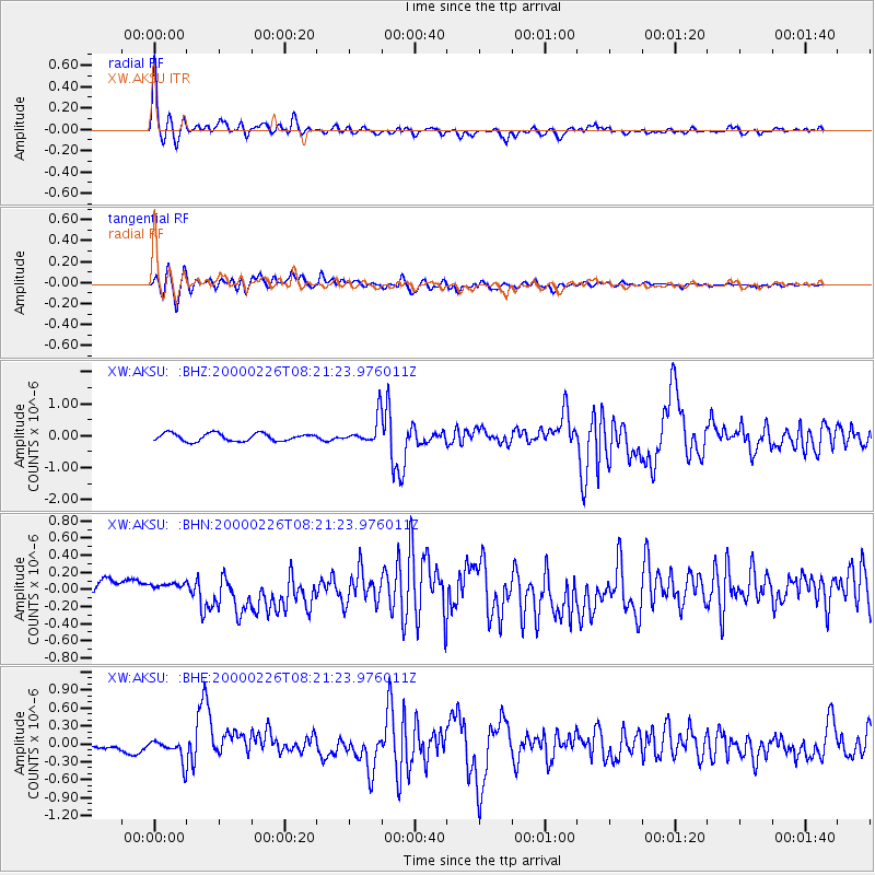
Earthquake location: Mariana Islands
Earthquake latitude/longitude: 13.8/144.8
Earthquake time(UTC): 2000/02/26 (057) 08:11:48 GMT
Earthquake Depth: 132 km
Earthquake Magnitude: 6.0 MB, 5.4 MS, 6.2 MW, 6.2 MW
Earthquake Catalog/Contributor: WHDF/NEIC
Network: XW Tien Shan Continental Dynamics
Station: AKSU XW.AKSU
Lat/Lon: 41.14 N/80.11 E
Elevation: 1109 m
Distance: 62.0 deg
Az: 309.375 deg
Baz: 96.075 deg
Ray Param: 0.06011459
Estimated Moho Depth: 14.0 km
Estimated Crust Vp/Vs: 1.97
Assumed Crust Vp: 6.129 km/s
Estimated Crust Vs: 3.107 km/s
Estimated Crust Poisson's Ratio: 0.33
Radial Match: 89.184746 %
Radial Bump: 400
Transverse Match: 76.367004 %
Transverse Bump: 400
SOD ConfigId: 20082
Insert Time: 2010-02-26 15:14:40.734 +0000
GWidth: 2.5
Max Bumps: 400
Tol: 0.001

Signal To Noise

ChannelStoNSTALTA
XW:AKSU: :BHN:20000226T08:21:23.976011Z0.522988144.5535113E-88.70672E-8
XW:AKSU: :BHE:20000226T08:21:23.976011Z4.52403451.7568163E-73.8832958E-8
XW:AKSU: :BHZ:20000226T08:21:23.976011Z3.54897954.2538693E-71.1986175E-7
Arrivals
Ps2.3 SECOND
PpPs6.5 SECOND
PsPs/PpSs8.9 SECOND