You are here: Home > Network List > WY - Yellowstone Wyoming Seismic Network Stations List
> Station YHR Hawk's Rest, WY, USA > Earthquake Result Viewer
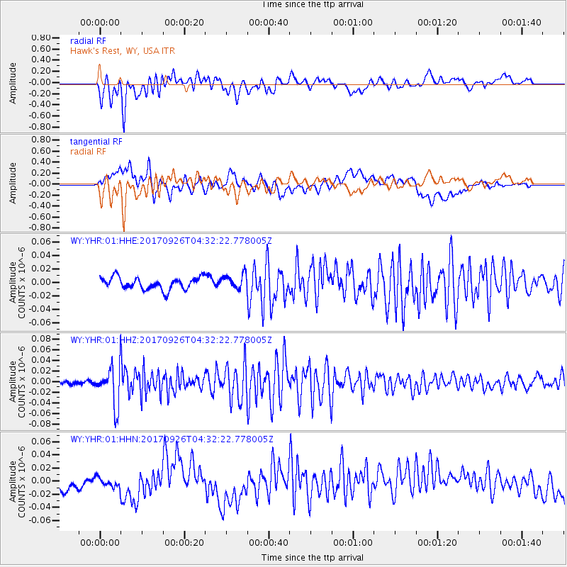
YHR Hawk's Rest, WY, USA - Earthquake Result Viewer
*The percent match for this event was below the threshold and hence no stack was calculated.
| Earthquake location: |
South Of Fiji Islands |
| Earthquake latitude/longitude: |
-23.7/-176.9 |
| Earthquake time(UTC): |
2017/09/26 (269) 04:20:00 GMT |
| Earthquake Depth: |
98 km |
| Earthquake Magnitude: |
6.4 mww |
| Earthquake Catalog/Contributor: |
NEIC PDE/us |
|
| Network: |
WY Yellowstone Wyoming Seismic Network |
| Station: |
YHR Hawk's Rest, WY, USA |
| Lat/Lon: |
44.11 N/110.08 W |
| Elevation: |
2976 m |
|
| Distance: |
91.0 deg |
| Az: |
41.492 deg |
| Baz: |
237.45 deg |
| Ray Param: |
$rayparam |
*The percent match for this event was below the threshold and hence was not used in the summary stack. |
|
| Radial Match: |
67.33896 % |
| Radial Bump: |
400 |
| Transverse Match: |
50.293354 % |
| Transverse Bump: |
400 |
| SOD ConfigId: |
2364251 |
| Insert Time: |
2017-10-10 04:28:14.866 +0000 |
| GWidth: |
2.5 |
| Max Bumps: |
400 |
| Tol: |
0.001 |
|
Signal To Noise
| Channel | StoN | STA | LTA |
| WY:YHR:01:HHZ:20170926T04:32:22.778005Z | 13.307712 | 3.8880955E-8 | 2.9216858E-9 |
| WY:YHR:01:HHN:20170926T04:32:22.778005Z | 0.8233598 | 7.1234068E-9 | 8.651633E-9 |
| WY:YHR:01:HHE:20170926T04:32:22.778005Z | 1.2702137 | 1.1354137E-8 | 8.938762E-9 |
| Arrivals |
| Ps | |
| PpPs | |
| PsPs/PpSs | |


