You are here: Home > Network List > US - United States National Seismic Network Stations List
> Station AMTX Amarillo, Texas, USA > Earthquake Result Viewer
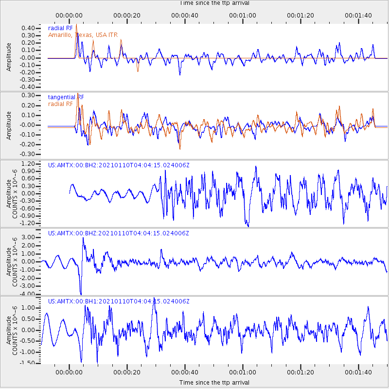
AMTX Amarillo, Texas, USA - Earthquake Result Viewer
*The percent match for this event was below the threshold and hence no stack was calculated.
| Earthquake location: |
Salta Province, Argentina |
| Earthquake latitude/longitude: |
-24.0/-66.7 |
| Earthquake time(UTC): |
2021/01/10 (010) 03:54:12 GMT |
| Earthquake Depth: |
203 km |
| Earthquake Magnitude: |
6.1 mww |
| Earthquake Catalog/Contributor: |
NEIC PDE/us |
|
| Network: |
US United States National Seismic Network |
| Station: |
AMTX Amarillo, Texas, USA |
| Lat/Lon: |
34.53 N/101.41 W |
| Elevation: |
1010 m |
|
| Distance: |
66.9 deg |
| Az: |
329.246 deg |
| Baz: |
145.503 deg |
| Ray Param: |
$rayparam |
*The percent match for this event was below the threshold and hence was not used in the summary stack. |
|
| Radial Match: |
66.093376 % |
| Radial Bump: |
400 |
| Transverse Match: |
66.38417 % |
| Transverse Bump: |
400 |
| SOD ConfigId: |
23341671 |
| Insert Time: |
2021-01-24 05:18:18.413 +0000 |
| GWidth: |
2.5 |
| Max Bumps: |
400 |
| Tol: |
0.001 |
|
Signal To Noise
| Channel | StoN | STA | LTA |
| US:AMTX:00:BHZ:20210110T04:04:15.024006Z | 3.0120082 | 1.4736709E-6 | 4.892652E-7 |
| US:AMTX:00:BH1:20210110T04:04:15.024006Z | 1.1094602 | 5.072536E-7 | 4.5720756E-7 |
| US:AMTX:00:BH2:20210110T04:04:15.024006Z | 1.9812502 | 3.1297466E-7 | 1.5796826E-7 |
| Arrivals |
| Ps | |
| PpPs | |
| PsPs/PpSs | |


