
AKSU XW.AKSU - Earthquake Result Viewer
| ||||||||||||||||||
| ||||||||||||||||||
| ||||||||||||||||||
|
Signal To Noise
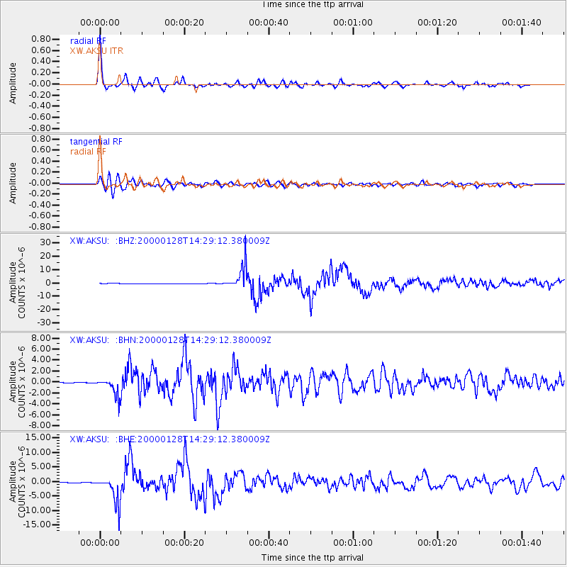
| Channel | StoN | STA | LTA |
| XW:AKSU: :BHN:20000128T14:29:12.380009Z | 10.746157 | 1.6238909E-6 | 1.5111364E-7 |
| XW:AKSU: :BHE:20000128T14:29:12.380009Z | 96.06777 | 4.9289947E-6 | 5.1307474E-8 |
| XW:AKSU: :BHZ:20000128T14:29:12.380009Z | 115.7122 | 8.799773E-6 | 7.60488E-8 |
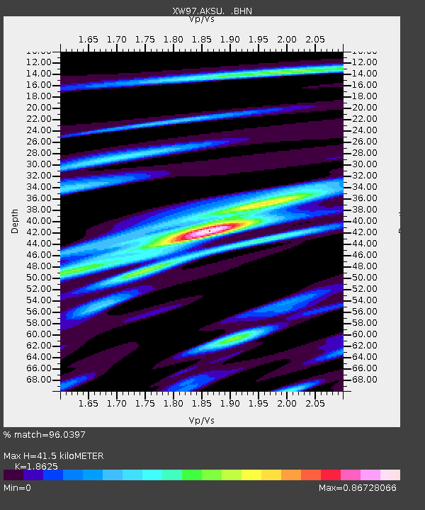
| Arrivals | |
| Ps | 6.1 SECOND |
| PpPs | 18 SECOND |
| PsPs/PpSs | 25 SECOND |

