You are here: Home > Network List > US - United States National Seismic Network Stations List
> Station AMTX Amarillo, Texas, USA > Earthquake Result Viewer
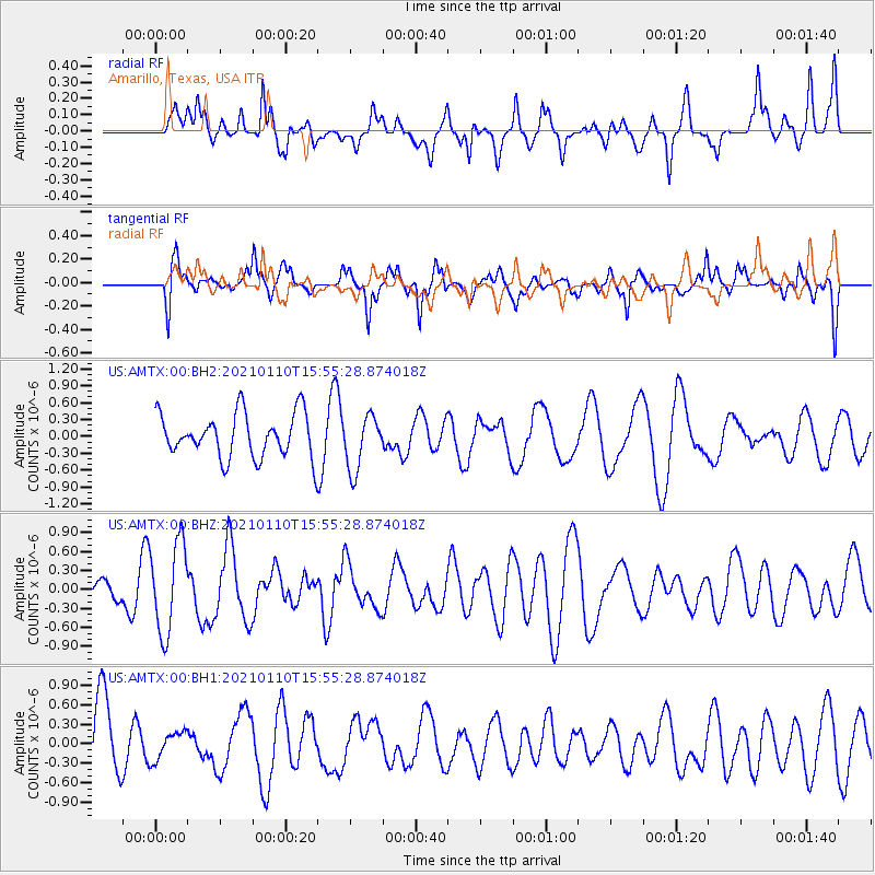
AMTX Amarillo, Texas, USA - Earthquake Result Viewer
*The percent match for this event was below the threshold and hence no stack was calculated.
| Earthquake location: |
Southern East Pacific Rise |
| Earthquake latitude/longitude: |
-35.4/-105.9 |
| Earthquake time(UTC): |
2021/01/10 (010) 15:44:48 GMT |
| Earthquake Depth: |
10 km |
| Earthquake Magnitude: |
5.6 Mww |
| Earthquake Catalog/Contributor: |
NEIC PDE/us |
|
| Network: |
US United States National Seismic Network |
| Station: |
AMTX Amarillo, Texas, USA |
| Lat/Lon: |
34.53 N/101.41 W |
| Elevation: |
1010 m |
|
| Distance: |
69.7 deg |
| Az: |
3.921 deg |
| Baz: |
183.88 deg |
| Ray Param: |
$rayparam |
*The percent match for this event was below the threshold and hence was not used in the summary stack. |
|
| Radial Match: |
57.100883 % |
| Radial Bump: |
400 |
| Transverse Match: |
72.4506 % |
| Transverse Bump: |
400 |
| SOD ConfigId: |
23341671 |
| Insert Time: |
2021-01-24 16:58:31.024 +0000 |
| GWidth: |
2.5 |
| Max Bumps: |
400 |
| Tol: |
0.001 |
|
Signal To Noise
| Channel | StoN | STA | LTA |
| US:AMTX:00:BHZ:20210110T15:55:28.874018Z | 2.8867862 | 7.055663E-7 | 2.444124E-7 |
| US:AMTX:00:BH1:20210110T15:55:28.874018Z | 0.3796986 | 2.1558557E-7 | 5.677808E-7 |
| US:AMTX:00:BH2:20210110T15:55:28.874018Z | 1.7709287 | 6.5720167E-7 | 3.7110564E-7 |
| Arrivals |
| Ps | |
| PpPs | |
| PsPs/PpSs | |


