You are here: Home > Network List > AV - Alaska Volcano Observatory Stations List
> Station MAPS Pakushin Southeast, Makushin Volcano, Alaska > Earthquake Result Viewer
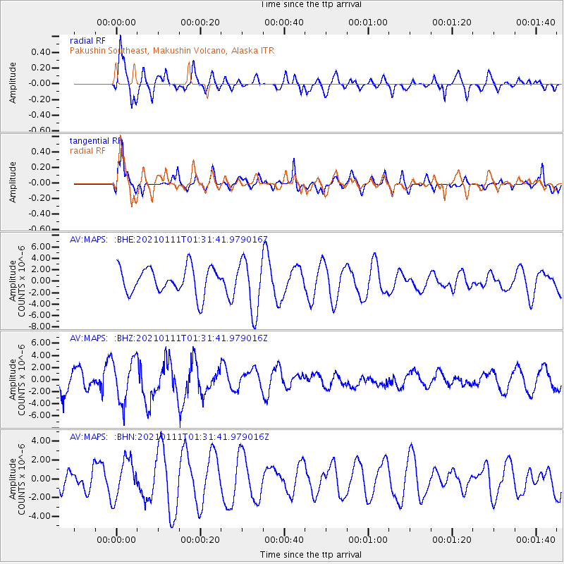
MAPS Pakushin Southeast, Makushin Volcano, Alaska - Earthquake Result Viewer
*The percent match for this event was below the threshold and hence no stack was calculated.
| Earthquake location: |
Flores Sea |
| Earthquake latitude/longitude: |
-7.2/120.5 |
| Earthquake time(UTC): |
2021/01/11 (011) 01:20:38 GMT |
| Earthquake Depth: |
618 km |
| Earthquake Magnitude: |
5.6 mww |
| Earthquake Catalog/Contributor: |
NEIC PDE/us |
|
| Network: |
AV Alaska Volcano Observatory |
| Station: |
MAPS Pakushin Southeast, Makushin Volcano, Alaska |
| Lat/Lon: |
53.81 N/166.94 W |
| Elevation: |
333 m |
|
| Distance: |
85.7 deg |
| Az: |
34.58 deg |
| Baz: |
251.702 deg |
| Ray Param: |
$rayparam |
*The percent match for this event was below the threshold and hence was not used in the summary stack. |
|
| Radial Match: |
62.95933 % |
| Radial Bump: |
400 |
| Transverse Match: |
64.82279 % |
| Transverse Bump: |
393 |
| SOD ConfigId: |
23341671 |
| Insert Time: |
2021-01-25 02:23:15.492 +0000 |
| GWidth: |
2.5 |
| Max Bumps: |
400 |
| Tol: |
0.001 |
|
Signal To Noise
| Channel | StoN | STA | LTA |
| AV:MAPS: :BHZ:20210111T01:31:41.979016Z | 2.06938 | 3.5037842E-6 | 1.6931565E-6 |
| AV:MAPS: :BHN:20210111T01:31:41.979016Z | 1.346909 | 2.0425528E-6 | 1.5164742E-6 |
| AV:MAPS: :BHE:20210111T01:31:41.979016Z | 2.08926 | 4.804248E-6 | 2.299497E-6 |
| Arrivals |
| Ps | |
| PpPs | |
| PsPs/PpSs | |


