You are here: Home > Network List > G - GEOSCOPE Stations List
> Station KIP Kipapa, Hawai, U.S.A. (Pacific Ocean) > Earthquake Result Viewer
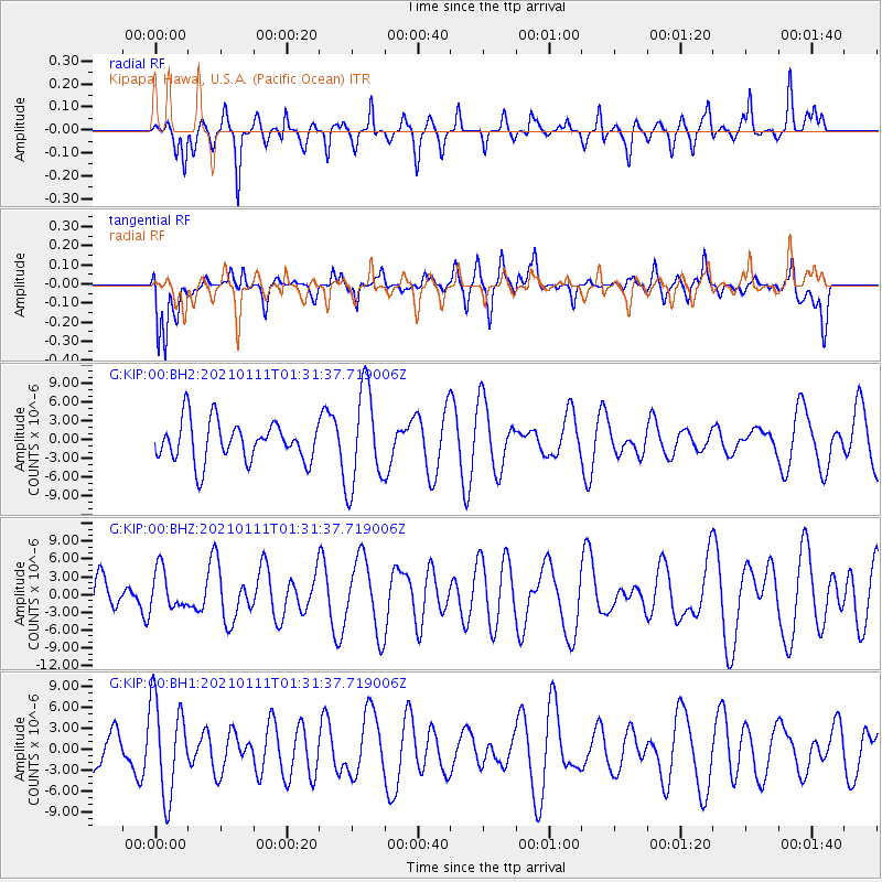
KIP Kipapa, Hawai, U.S.A. (Pacific Ocean) - Earthquake Result Viewer
*The percent match for this event was below the threshold and hence no stack was calculated.
| Earthquake location: |
Flores Sea |
| Earthquake latitude/longitude: |
-7.2/120.5 |
| Earthquake time(UTC): |
2021/01/11 (011) 01:20:38 GMT |
| Earthquake Depth: |
618 km |
| Earthquake Magnitude: |
5.6 mww |
| Earthquake Catalog/Contributor: |
NEIC PDE/us |
|
| Network: |
G GEOSCOPE |
| Station: |
KIP Kipapa, Hawai, U.S.A. (Pacific Ocean) |
| Lat/Lon: |
21.42 N/158.01 W |
| Elevation: |
70 m |
|
| Distance: |
84.8 deg |
| Az: |
67.727 deg |
| Baz: |
260.187 deg |
| Ray Param: |
$rayparam |
*The percent match for this event was below the threshold and hence was not used in the summary stack. |
|
| Radial Match: |
38.525665 % |
| Radial Bump: |
302 |
| Transverse Match: |
57.375866 % |
| Transverse Bump: |
400 |
| SOD ConfigId: |
23341671 |
| Insert Time: |
2021-01-25 02:23:59.389 +0000 |
| GWidth: |
2.5 |
| Max Bumps: |
400 |
| Tol: |
0.001 |
|
Signal To Noise
| Channel | StoN | STA | LTA |
| G:KIP:00:BHZ:20210111T01:31:37.719006Z | 0.8726044 | 3.3209296E-6 | 3.8057674E-6 |
| G:KIP:00:BH1:20210111T01:31:37.719006Z | 1.2849413 | 6.8263444E-6 | 5.312573E-6 |
| G:KIP:00:BH2:20210111T01:31:37.719006Z | 2.4365156 | 7.811285E-6 | 3.2059247E-6 |
| Arrivals |
| Ps | |
| PpPs | |
| PsPs/PpSs | |


