You are here: Home > Network List > US - United States National Seismic Network Stations List
> Station AMTX Amarillo, Texas, USA > Earthquake Result Viewer
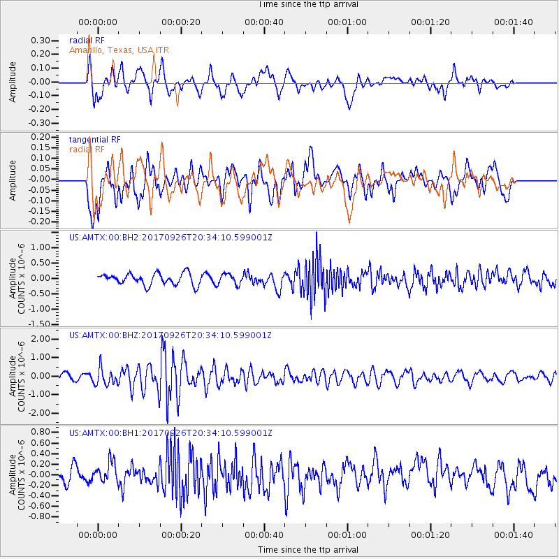
AMTX Amarillo, Texas, USA - Earthquake Result Viewer
*The percent match for this event was below the threshold and hence no stack was calculated.
| Earthquake location: |
Near East Coast Of Honshu, Japan |
| Earthquake latitude/longitude: |
40.3/142.4 |
| Earthquake time(UTC): |
2017/09/26 (269) 20:22:11 GMT |
| Earthquake Depth: |
36 km |
| Earthquake Magnitude: |
5.8 Mww |
| Earthquake Catalog/Contributor: |
NEIC PDE/us |
|
| Network: |
US United States National Seismic Network |
| Station: |
AMTX Amarillo, Texas, USA |
| Lat/Lon: |
34.53 N/101.41 W |
| Elevation: |
1010 m |
|
| Distance: |
85.1 deg |
| Az: |
48.036 deg |
| Baz: |
316.48 deg |
| Ray Param: |
$rayparam |
*The percent match for this event was below the threshold and hence was not used in the summary stack. |
|
| Radial Match: |
51.825115 % |
| Radial Bump: |
400 |
| Transverse Match: |
63.10922 % |
| Transverse Bump: |
400 |
| SOD ConfigId: |
2364251 |
| Insert Time: |
2017-10-10 20:36:22.582 +0000 |
| GWidth: |
2.5 |
| Max Bumps: |
400 |
| Tol: |
0.001 |
|
Signal To Noise
| Channel | StoN | STA | LTA |
| US:AMTX:00:BHZ:20170926T20:34:10.599001Z | 2.268807 | 4.6581343E-7 | 2.0531206E-7 |
| US:AMTX:00:BH1:20170926T20:34:10.599001Z | 1.0311954 | 2.0889402E-7 | 2.0257464E-7 |
| US:AMTX:00:BH2:20170926T20:34:10.599001Z | 0.9291859 | 1.753346E-7 | 1.88697E-7 |
| Arrivals |
| Ps | |
| PpPs | |
| PsPs/PpSs | |


