You are here: Home > Network List > US - United States National Seismic Network Stations List
> Station CBKS Cedar Bluff, Kansas, USA > Earthquake Result Viewer
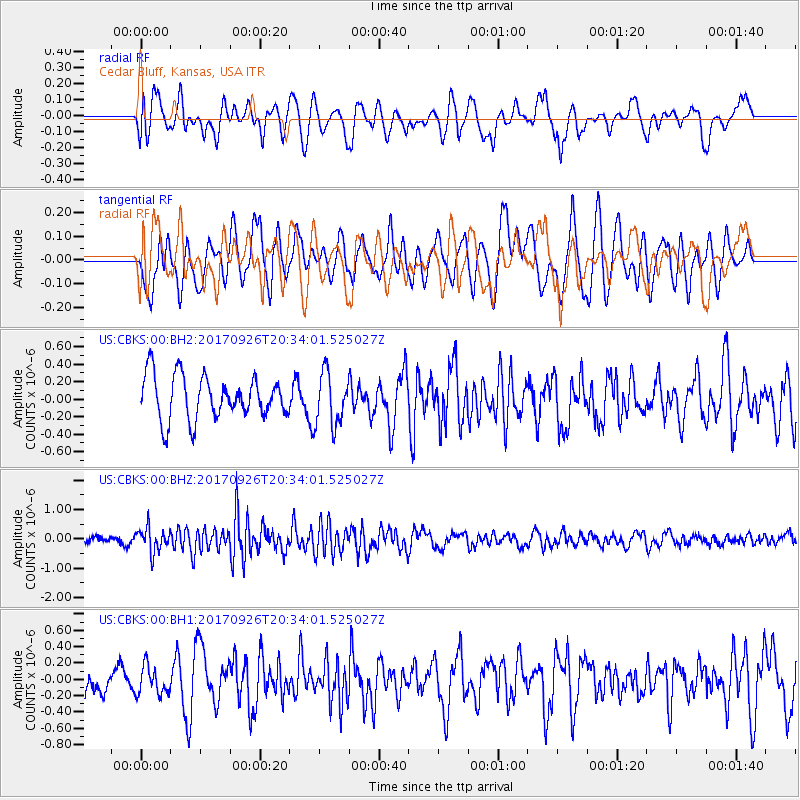
CBKS Cedar Bluff, Kansas, USA - Earthquake Result Viewer
*The percent match for this event was below the threshold and hence no stack was calculated.
| Earthquake location: |
Near East Coast Of Honshu, Japan |
| Earthquake latitude/longitude: |
40.3/142.4 |
| Earthquake time(UTC): |
2017/09/26 (269) 20:22:11 GMT |
| Earthquake Depth: |
36 km |
| Earthquake Magnitude: |
5.8 Mww |
| Earthquake Catalog/Contributor: |
NEIC PDE/us |
|
| Network: |
US United States National Seismic Network |
| Station: |
CBKS Cedar Bluff, Kansas, USA |
| Lat/Lon: |
38.81 N/99.74 W |
| Elevation: |
677 m |
|
| Distance: |
82.9 deg |
| Az: |
44.108 deg |
| Baz: |
317.065 deg |
| Ray Param: |
$rayparam |
*The percent match for this event was below the threshold and hence was not used in the summary stack. |
|
| Radial Match: |
60.512558 % |
| Radial Bump: |
400 |
| Transverse Match: |
51.466278 % |
| Transverse Bump: |
400 |
| SOD ConfigId: |
2364251 |
| Insert Time: |
2017-10-10 20:36:33.176 +0000 |
| GWidth: |
2.5 |
| Max Bumps: |
400 |
| Tol: |
0.001 |
|
Signal To Noise
| Channel | StoN | STA | LTA |
| US:CBKS:00:BHZ:20170926T20:34:01.525027Z | 2.5130577 | 3.9973503E-7 | 1.5906322E-7 |
| US:CBKS:00:BH1:20170926T20:34:01.525027Z | 0.91844255 | 1.9026282E-7 | 2.0715811E-7 |
| US:CBKS:00:BH2:20170926T20:34:01.525027Z | 1.2304734 | 3.0464795E-7 | 2.4758597E-7 |
| Arrivals |
| Ps | |
| PpPs | |
| PsPs/PpSs | |


