
ANA XW.ANA - Earthquake Result Viewer
| ||||||||||||||||||
| ||||||||||||||||||
| ||||||||||||||||||
|
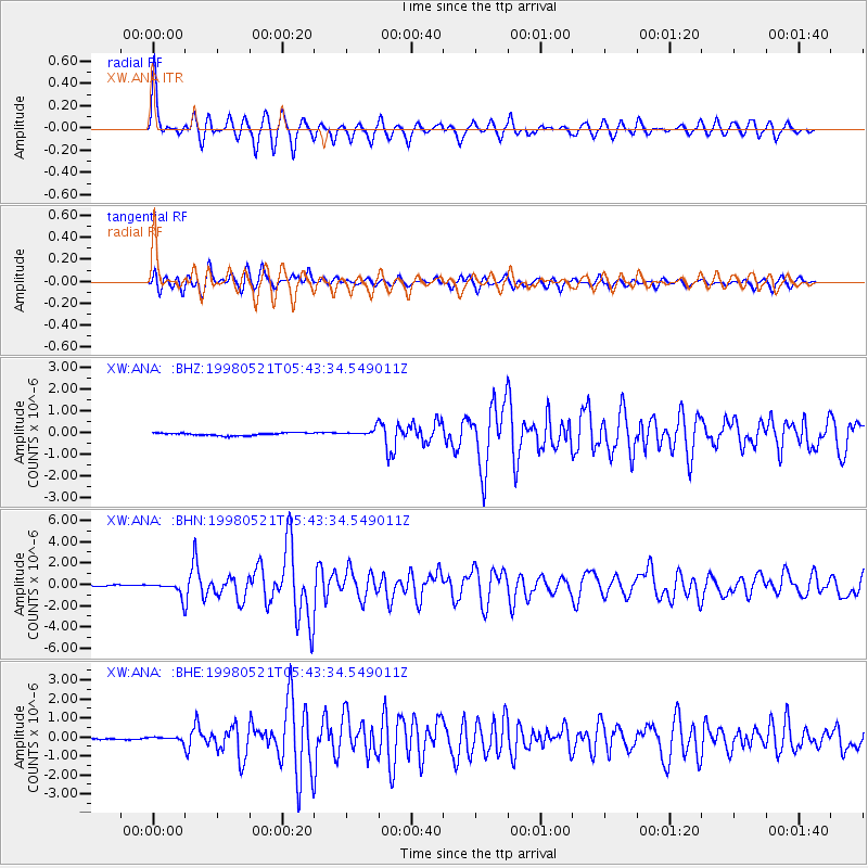
Signal To Noise
| Channel | StoN | STA | LTA |
| XW:ANA: :BHN:19980521T05:43:34.549011Z | 9.875862 | 6.308386E-7 | 6.387681E-8 |
| XW:ANA: :BHE:19980521T05:43:34.549011Z | 2.96487 | 9.2092066E-8 | 3.106108E-8 |
| XW:ANA: :BHZ:19980521T05:43:34.549011Z | 2.8793893 | 1.6695232E-7 | 5.798185E-8 |
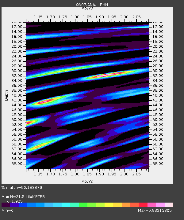
| Arrivals | |
| Ps | 4.8 SECOND |
| PpPs | 14 SECOND |
| PsPs/PpSs | 19 SECOND |

