You are here: Home > Network List > G - GEOSCOPE Stations List
> Station MPG Montagne des Peres, French Guyana > Earthquake Result Viewer
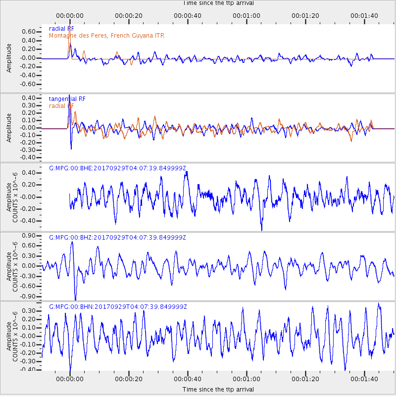
MPG Montagne des Peres, French Guyana - Earthquake Result Viewer
*The percent match for this event was below the threshold and hence no stack was calculated.
| Earthquake location: |
Off Coast Of Chiapas, Mexico |
| Earthquake latitude/longitude: |
14.9/-94.0 |
| Earthquake time(UTC): |
2017/09/29 (272) 04:00:22 GMT |
| Earthquake Depth: |
22 km |
| Earthquake Magnitude: |
5.6 mb |
| Earthquake Catalog/Contributor: |
NEIC PDE/us |
|
| Network: |
G GEOSCOPE |
| Station: |
MPG Montagne des Peres, French Guyana |
| Lat/Lon: |
5.11 N/52.64 W |
| Elevation: |
147 m |
|
| Distance: |
41.8 deg |
| Az: |
99.092 deg |
| Baz: |
286.585 deg |
| Ray Param: |
$rayparam |
*The percent match for this event was below the threshold and hence was not used in the summary stack. |
|
| Radial Match: |
59.870987 % |
| Radial Bump: |
400 |
| Transverse Match: |
53.788647 % |
| Transverse Bump: |
400 |
| SOD ConfigId: |
2364251 |
| Insert Time: |
2017-10-13 04:00:50.735 +0000 |
| GWidth: |
2.5 |
| Max Bumps: |
400 |
| Tol: |
0.001 |
|
Signal To Noise
| Channel | StoN | STA | LTA |
| G:MPG:00:BHZ:20170929T04:07:39.849999Z | 3.4912844 | 4.5874702E-7 | 1.3139778E-7 |
| G:MPG:00:BHN:20170929T04:07:39.849999Z | 1.6100625 | 1.9069425E-7 | 1.1843904E-7 |
| G:MPG:00:BHE:20170929T04:07:39.849999Z | 1.2736368 | 1.8393071E-7 | 1.4441379E-7 |
| Arrivals |
| Ps | |
| PpPs | |
| PsPs/PpSs | |


