You are here: Home > Network List > UW - Pacific Northwest Regional Seismic Network Stations List
> Station IRON Crane, OR, USA > Earthquake Result Viewer
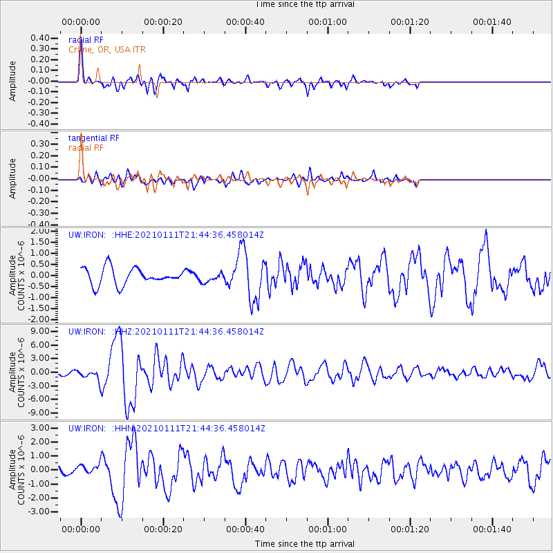
IRON Crane, OR, USA - Earthquake Result Viewer
*The percent match for this event was below the threshold and hence no stack was calculated.
| Earthquake location: |
Russia-Mongolia Border Region |
| Earthquake latitude/longitude: |
51.2/100.4 |
| Earthquake time(UTC): |
2021/01/11 (011) 21:32:58 GMT |
| Earthquake Depth: |
10 km |
| Earthquake Magnitude: |
6.7 mww |
| Earthquake Catalog/Contributor: |
NEIC PDE/us |
|
| Network: |
UW Pacific Northwest Regional Seismic Network |
| Station: |
IRON Crane, OR, USA |
| Lat/Lon: |
43.36 N/118.47 W |
| Elevation: |
1226 m |
|
| Distance: |
79.9 deg |
| Az: |
27.732 deg |
| Baz: |
336.356 deg |
| Ray Param: |
$rayparam |
*The percent match for this event was below the threshold and hence was not used in the summary stack. |
|
| Radial Match: |
75.6073 % |
| Radial Bump: |
381 |
| Transverse Match: |
71.99836 % |
| Transverse Bump: |
400 |
| SOD ConfigId: |
23341671 |
| Insert Time: |
2021-01-25 23:06:03.540 +0000 |
| GWidth: |
2.5 |
| Max Bumps: |
400 |
| Tol: |
0.001 |
|
Signal To Noise
| Channel | StoN | STA | LTA |
| UW:IRON: :HHZ:20210111T21:44:36.458014Z | 4.060889 | 1.1190331E-6 | 2.755636E-7 |
| UW:IRON: :HHN:20210111T21:44:36.458014Z | 0.8900027 | 3.112612E-7 | 3.497306E-7 |
| UW:IRON: :HHE:20210111T21:44:36.458014Z | 0.5490781 | 2.0754885E-7 | 3.7799515E-7 |
| Arrivals |
| Ps | |
| PpPs | |
| PsPs/PpSs | |


