You are here: Home > Network List > CN - Canadian National Seismograph Network Stations List
> Station INK INUVIK, NT > Earthquake Result Viewer
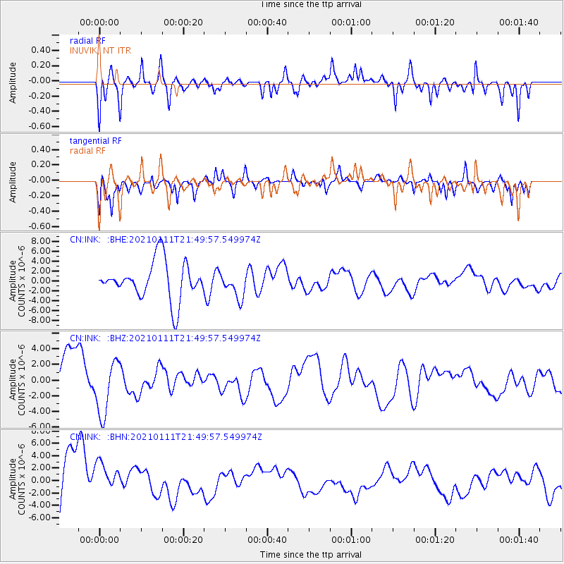
INK INUVIK, NT - Earthquake Result Viewer
*The percent match for this event was below the threshold and hence no stack was calculated.
| Earthquake location: |
Russia-Mongolia Border Region |
| Earthquake latitude/longitude: |
51.5/100.5 |
| Earthquake time(UTC): |
2021/01/11 (011) 21:41:04 GMT |
| Earthquake Depth: |
10 km |
| Earthquake Magnitude: |
5.8 mb |
| Earthquake Catalog/Contributor: |
NEIC PDE/us |
|
| Network: |
CN Canadian National Seismograph Network |
| Station: |
INK INUVIK, NT |
| Lat/Lon: |
68.31 N/133.53 W |
| Elevation: |
44 m |
|
| Distance: |
54.0 deg |
| Az: |
21.84 deg |
| Baz: |
321.269 deg |
| Ray Param: |
$rayparam |
*The percent match for this event was below the threshold and hence was not used in the summary stack. |
|
| Radial Match: |
37.998352 % |
| Radial Bump: |
400 |
| Transverse Match: |
47.462677 % |
| Transverse Bump: |
330 |
| SOD ConfigId: |
23341671 |
| Insert Time: |
2021-01-25 23:15:57.610 +0000 |
| GWidth: |
2.5 |
| Max Bumps: |
400 |
| Tol: |
0.001 |
|
Signal To Noise
| Channel | StoN | STA | LTA |
| CN:INK: :BHZ:20210111T21:49:57.549974Z | 1.3283999 | 3.615037E-6 | 2.7213468E-6 |
| CN:INK: :BHN:20210111T21:49:57.549974Z | 0.43870637 | 2.8767472E-6 | 6.557341E-6 |
| CN:INK: :BHE:20210111T21:49:57.549974Z | 0.6996095 | 2.6610621E-6 | 3.8036394E-6 |
| Arrivals |
| Ps | |
| PpPs | |
| PsPs/PpSs | |


