You are here: Home > Network List > US - United States National Seismic Network Stations List
> Station DGMT Dagmar, Montana, USA > Earthquake Result Viewer
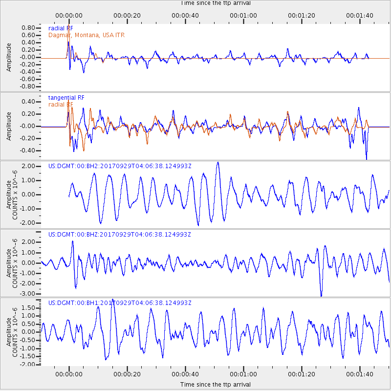
DGMT Dagmar, Montana, USA - Earthquake Result Viewer
*The percent match for this event was below the threshold and hence no stack was calculated.
| Earthquake location: |
Off Coast Of Chiapas, Mexico |
| Earthquake latitude/longitude: |
14.9/-94.0 |
| Earthquake time(UTC): |
2017/09/29 (272) 04:00:22 GMT |
| Earthquake Depth: |
22 km |
| Earthquake Magnitude: |
5.6 mb |
| Earthquake Catalog/Contributor: |
NEIC PDE/us |
|
| Network: |
US United States National Seismic Network |
| Station: |
DGMT Dagmar, Montana, USA |
| Lat/Lon: |
48.47 N/104.20 W |
| Elevation: |
0.0 m |
|
| Distance: |
34.5 deg |
| Az: |
348.052 deg |
| Baz: |
162.498 deg |
| Ray Param: |
$rayparam |
*The percent match for this event was below the threshold and hence was not used in the summary stack. |
|
| Radial Match: |
33.076168 % |
| Radial Bump: |
400 |
| Transverse Match: |
42.835335 % |
| Transverse Bump: |
399 |
| SOD ConfigId: |
2364251 |
| Insert Time: |
2017-10-13 04:02:44.926 +0000 |
| GWidth: |
2.5 |
| Max Bumps: |
400 |
| Tol: |
0.001 |
|
Signal To Noise
| Channel | StoN | STA | LTA |
| US:DGMT:00:BHZ:20170929T04:06:38.124993Z | 5.3022933 | 1.1133124E-6 | 2.0996809E-7 |
| US:DGMT:00:BH1:20170929T04:06:38.124993Z | 0.55528146 | 4.560422E-7 | 8.212811E-7 |
| US:DGMT:00:BH2:20170929T04:06:38.124993Z | 0.6548872 | 6.102577E-7 | 9.318516E-7 |
| Arrivals |
| Ps | |
| PpPs | |
| PsPs/PpSs | |


