You are here: Home > Network List > US - United States National Seismic Network Stations List
> Station EGMT Eagleton, Montana, USA > Earthquake Result Viewer
EGMT Eagleton, Montana, USA - Earthquake Result Viewer
*The percent match for this event was below the threshold and hence no stack was calculated.
| Earthquake location: |
Off Coast Of Chiapas, Mexico |
| Earthquake latitude/longitude: |
14.9/-94.0 |
| Earthquake time(UTC): |
2017/09/29 (272) 04:00:22 GMT |
| Earthquake Depth: |
22 km |
| Earthquake Magnitude: |
5.6 mb |
| Earthquake Catalog/Contributor: |
NEIC PDE/us |
|
| Network: |
US United States National Seismic Network |
| Station: |
EGMT Eagleton, Montana, USA |
| Lat/Lon: |
48.02 N/109.75 W |
| Elevation: |
1055 m |
|
| Distance: |
35.5 deg |
| Az: |
341.757 deg |
| Baz: |
153.203 deg |
| Ray Param: |
$rayparam |
*The percent match for this event was below the threshold and hence was not used in the summary stack. |
|
| Radial Match: |
75.10118 % |
| Radial Bump: |
400 |
| Transverse Match: |
62.442833 % |
| Transverse Bump: |
400 |
| SOD ConfigId: |
2364251 |
| Insert Time: |
2017-10-13 04:02:48.347 +0000 |
| GWidth: |
2.5 |
| Max Bumps: |
400 |
| Tol: |
0.001 |
|
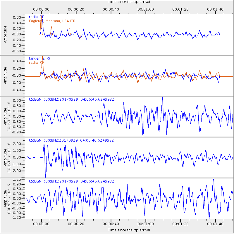
Signal To Noise
| Channel | StoN | STA | LTA |
| US:EGMT:00:BHZ:20170929T04:06:46.624993Z | 9.117489 | 1.2375706E-6 | 1.357359E-7 |
| US:EGMT:00:BH1:20170929T04:06:46.624993Z | 1.5456234 | 3.6775478E-7 | 2.3793297E-7 |
| US:EGMT:00:BH2:20170929T04:06:46.624993Z | 1.0772897 | 2.0841124E-7 | 1.9345886E-7 |
| Arrivals |
| Ps | |
| PpPs | |
| PsPs/PpSs | |


