You are here: Home > Network List > US - United States National Seismic Network Stations List
> Station MSO Missoula, Montana, USA > Earthquake Result Viewer
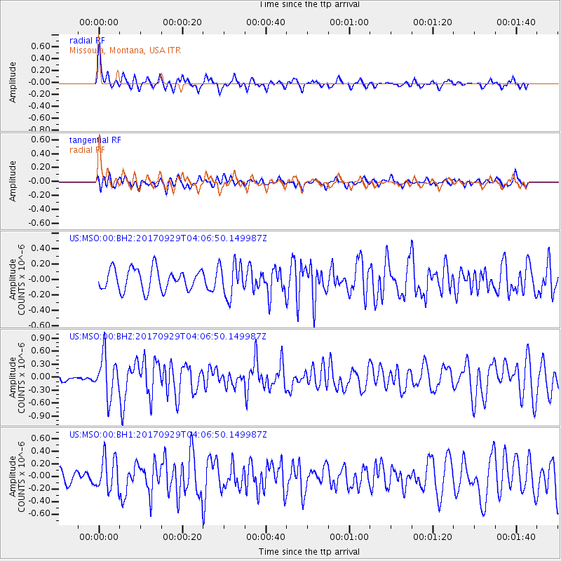
MSO Missoula, Montana, USA - Earthquake Result Viewer
*The percent match for this event was below the threshold and hence no stack was calculated.
| Earthquake location: |
Off Coast Of Chiapas, Mexico |
| Earthquake latitude/longitude: |
14.9/-94.0 |
| Earthquake time(UTC): |
2017/09/29 (272) 04:00:22 GMT |
| Earthquake Depth: |
22 km |
| Earthquake Magnitude: |
5.6 mb |
| Earthquake Catalog/Contributor: |
NEIC PDE/us |
|
| Network: |
US United States National Seismic Network |
| Station: |
MSO Missoula, Montana, USA |
| Lat/Lon: |
46.83 N/113.94 W |
| Elevation: |
1264 m |
|
| Distance: |
35.9 deg |
| Az: |
336.52 deg |
| Baz: |
145.874 deg |
| Ray Param: |
$rayparam |
*The percent match for this event was below the threshold and hence was not used in the summary stack. |
|
| Radial Match: |
69.95125 % |
| Radial Bump: |
372 |
| Transverse Match: |
54.985706 % |
| Transverse Bump: |
400 |
| SOD ConfigId: |
2364251 |
| Insert Time: |
2017-10-13 04:03:05.320 +0000 |
| GWidth: |
2.5 |
| Max Bumps: |
400 |
| Tol: |
0.001 |
|
Signal To Noise
| Channel | StoN | STA | LTA |
| US:MSO:00:BHZ:20170929T04:06:50.149987Z | 3.335378 | 4.838883E-7 | 1.450775E-7 |
| US:MSO:00:BH1:20170929T04:06:50.149987Z | 2.168955 | 2.6494715E-7 | 1.2215428E-7 |
| US:MSO:00:BH2:20170929T04:06:50.149987Z | 1.5416489 | 2.1404001E-7 | 1.3883836E-7 |
| Arrivals |
| Ps | |
| PpPs | |
| PsPs/PpSs | |


