You are here: Home > Network List > CI - Caltech Regional Seismic Network Stations List
> Station SWS Sam W. Stewart, Westmorland, CA, USA > Earthquake Result Viewer
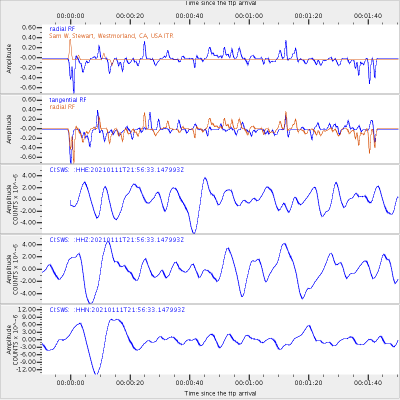
SWS Sam W. Stewart, Westmorland, CA, USA - Earthquake Result Viewer
*The percent match for this event was below the threshold and hence no stack was calculated.
| Earthquake location: |
Russia-Mongolia Border Region |
| Earthquake latitude/longitude: |
51.4/100.5 |
| Earthquake time(UTC): |
2021/01/11 (011) 21:44:04 GMT |
| Earthquake Depth: |
10 km |
| Earthquake Magnitude: |
5.7 mb |
| Earthquake Catalog/Contributor: |
NEIC PDE/us |
|
| Network: |
CI Caltech Regional Seismic Network |
| Station: |
SWS Sam W. Stewart, Westmorland, CA, USA |
| Lat/Lon: |
32.94 N/115.80 W |
| Elevation: |
140 m |
|
| Distance: |
90.2 deg |
| Az: |
29.847 deg |
| Baz: |
338.241 deg |
| Ray Param: |
$rayparam |
*The percent match for this event was below the threshold and hence was not used in the summary stack. |
|
| Radial Match: |
45.905556 % |
| Radial Bump: |
400 |
| Transverse Match: |
50.530266 % |
| Transverse Bump: |
371 |
| SOD ConfigId: |
23341671 |
| Insert Time: |
2021-01-25 23:36:09.233 +0000 |
| GWidth: |
2.5 |
| Max Bumps: |
400 |
| Tol: |
0.001 |
|
Signal To Noise
| Channel | StoN | STA | LTA |
| CI:SWS: :HHZ:20210111T21:56:33.147993Z | 1.2313856 | 1.9963409E-6 | 1.621215E-6 |
| CI:SWS: :HHN:20210111T21:56:33.147993Z | 1.687093 | 4.955228E-6 | 2.9371397E-6 |
| CI:SWS: :HHE:20210111T21:56:33.147993Z | 0.7101715 | 1.348489E-6 | 1.8988217E-6 |
| Arrivals |
| Ps | |
| PpPs | |
| PsPs/PpSs | |


