You are here: Home > Network List > CN - Canadian National Seismograph Network Stations List
> Station INK INUVIK, NT > Earthquake Result Viewer
INK INUVIK, NT - Earthquake Result Viewer
*The percent match for this event was below the threshold and hence no stack was calculated.
| Earthquake location: |
Eastern Sea Of Japan |
| Earthquake latitude/longitude: |
43.7/140.0 |
| Earthquake time(UTC): |
2021/01/12 (012) 02:39:42 GMT |
| Earthquake Depth: |
211 km |
| Earthquake Magnitude: |
5.9 mww |
| Earthquake Catalog/Contributor: |
NEIC PDE/us |
|
| Network: |
CN Canadian National Seismograph Network |
| Station: |
INK INUVIK, NT |
| Lat/Lon: |
68.31 N/133.53 W |
| Elevation: |
44 m |
|
| Distance: |
49.0 deg |
| Az: |
29.438 deg |
| Baz: |
286.515 deg |
| Ray Param: |
$rayparam |
*The percent match for this event was below the threshold and hence was not used in the summary stack. |
|
| Radial Match: |
64.785675 % |
| Radial Bump: |
400 |
| Transverse Match: |
66.2592 % |
| Transverse Bump: |
400 |
| SOD ConfigId: |
23341671 |
| Insert Time: |
2021-01-26 03:50:00.162 +0000 |
| GWidth: |
2.5 |
| Max Bumps: |
400 |
| Tol: |
0.001 |
|
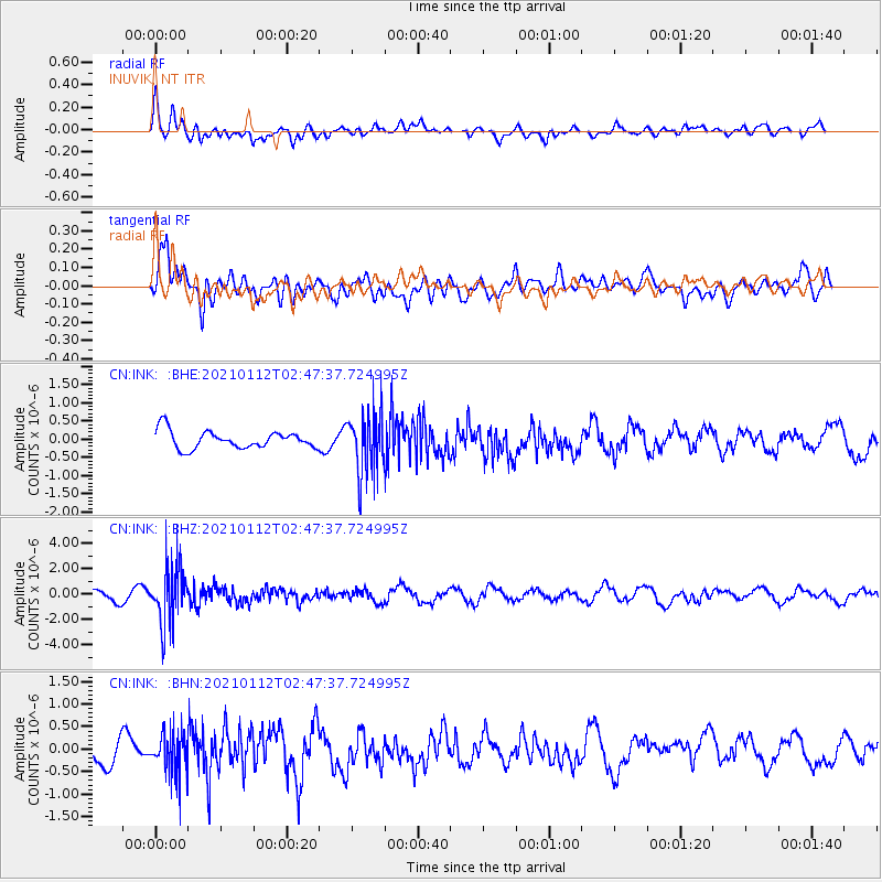
Signal To Noise
| Channel | StoN | STA | LTA |
| CN:INK: :BHZ:20210112T02:47:37.724995Z | 3.9834952 | 2.320837E-6 | 5.826132E-7 |
| CN:INK: :BHN:20210112T02:47:37.724995Z | 1.0705253 | 4.6875738E-7 | 4.3787603E-7 |
| CN:INK: :BHE:20210112T02:47:37.724995Z | 3.4604855 | 8.4256936E-7 | 2.43483E-7 |
| Arrivals |
| Ps | |
| PpPs | |
| PsPs/PpSs | |


